
IMAGES TAKEN NEAR TO
Crowthorne Road, SANDHURST, GU47 9EP
Introduction
This page details the photographs taken nearby to Crowthorne Road, GU47 9EP by members of the Geograph project.
The Geograph project started in 2005 with the aim of publishing, organising and preserving representative images for every square kilometre of Great Britain, Ireland and the Isle of Man.

There are currently over 7.5m images from over14,400 individuals and you can help contribute to the project by visiting https://www.geograph.org.uk
Image Map
Images are licensed for reuse under creativecommons.org/licenses/by-sa/2.0
Notes
- Clicking on the map will re-center to the selected point.
- The higher the marker number, the further away the image location is from the centre of the postcode.
Image Listing (57 Images Found)
Images are licensed for reuse under creativecommons.org/licenses/by-sa/2.0
Image
Details
Distance
1
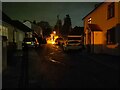
Newtown Road at night
An unsurfaced road between Yorktown Road (the A321) and Crowthorne Road in Sandhurst. It suffers with running water down the road which can be seen reflecting the light in this image and potholes. The houses mostly have names rather than numbers. Residents have fitted 'dead end' signs to either end of the road to dissuade people using it as a shortcut.
Image: © Oscar Taylor
Taken: 28 Mar 2023
0.08 miles
2
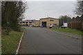
Sandhurst
The entrance to Lakeside Business Park, just south of Sandhurst Station.
Image: © Brendan and Ruth McCartney
Taken: Unknown
0.09 miles
3
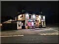
The Village Inn at night
A pub on the corner of Crowthorne Road and Yorktown Road (the A321) in Sandhurst.
Image: © Oscar Taylor
Taken: 28 Mar 2023
0.09 miles
4

Crowthorne Road at the junction of Yorktown Road
The Village Inn is on the left
Image: © David Howard
Taken: 23 Feb 2015
0.09 miles
5

The Village Inn on Yorktown Road, Sandhurst
Image: © David Howard
Taken: 23 Feb 2015
0.10 miles
7
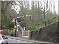
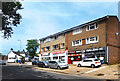
Sandhurst railway station
A view of the access path to Sandhurst station on the Guildford to Reading line, photographed on 16.4.2011.
Image: © John Attfield
Taken: 16 Apr 2011
0.12 miles
8
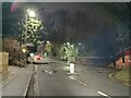
Yorktown Road from Scotland Hill at night
The corner leading under the railway bridge on Yorktown Road (the A321), viewed from Scotland Hill. The ramp up to the north platform at Sandhurst station can be seen as well. A recent change to this corner added a middle lane for those travelling west on Yorktown Road and wanting to turn right up Scotland Hill, to prevent traffic from being stopped.
Image: © Oscar Taylor
Taken: 28 Mar 2023
0.12 miles
9
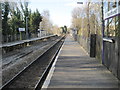
Sandhurst railway station, Berkshire
Opened in 1909 on the South Eastern & Chatham Railway's line from Reading to Redhill.
View north west towards Crowthorne and Reading.
Image: © Nigel Thompson
Taken: 6 Feb 2015
0.12 miles
