
IMAGES TAKEN NEAR TO
High Street, SANDHURST, GU47 8NS
Introduction
This page details the photographs taken nearby to High Street, GU47 8NS by members of the Geograph project.
The Geograph project started in 2005 with the aim of publishing, organising and preserving representative images for every square kilometre of Great Britain, Ireland and the Isle of Man.

There are currently over 7.5m images from over14,400 individuals and you can help contribute to the project by visiting https://www.geograph.org.uk
Image Map
Images are licensed for reuse under creativecommons.org/licenses/by-sa/2.0
Notes
- Clicking on the map will re-center to the selected point.
- The higher the marker number, the further away the image location is from the centre of the postcode.
Image Listing (16 Images Found)
Images are licensed for reuse under creativecommons.org/licenses/by-sa/2.0
Image
Details
Distance

4

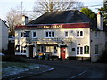
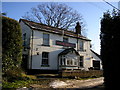
Sylvan Ridge
Corner entrance to Sylvan Ridge with hexagonal house on the right.
Image: © Ghost Viewer
Taken: 7 Mar 2026
0.13 miles
5
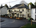
The Bird In Hand
The Bird In Hand public house on the corner of the Little Sandhurst Highstreet
Image: © Alan Hunt
Taken: 10 Jan 2014
0.13 miles
6

The Bird in Hand, Sandhurst
The Bird in Hand is a substantial-looking Greene King pub tucked away in the Little Sandhurst area.
Image: © Stephen McKay
Taken: 1 Apr 2026
0.13 miles
7
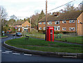
Edgbarrow Rise
The junction of Edgbarrow Rise with Longdown Road.
Image: © Alan Hunt
Taken: 10 Jan 2014
0.16 miles
8
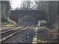
Church Road Bridge
Looking down the lines from the footpath crossing point towards the Church Road Bridge in Sandhurst on a hazy winter morning.
Image: © Alan Hunt
Taken: 14 Jan 2015
0.18 miles
9
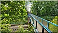
Pedestrian railway bridge
The railway is known as the North Downs Line. Built in 1849 by the Reading, Guildford and Reigate Railway Company.
https://en.wikipedia.org/wiki/North_Downs_Line
Image: © James Emmans
Taken: 30 Aug 2022
0.22 miles
10
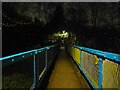
Sandhurst footbridge over railway at night
The footbridge in Sandhurst leading over the railway line, on the footpath from Scotland Hill to Mason Place (to the left at the junction after the railway bridge) or Perryhill Drive (straight on at the junction). The bridge is made of metal and is painted blue, though was once painted green.
A sign fixed to the bridge denotes its identifier and other information. It reads: "GTW2
19/1361
57m 53ch".
Image: © Oscar Taylor
Taken: 28 Mar 2023
0.22 miles