IMAGES TAKEN NEAR TO
Waterside Lane, SANDHURST, GU47 8AD
Introduction
This page details the photographs taken nearby to Waterside Lane, GU47 8AD by members of the Geograph project.
The Geograph project started in 2005 with the aim of publishing, organising and preserving representative images for every square kilometre of Great Britain, Ireland and the Isle of Man.

There are currently over 7.5m images from over14,400 individuals and you can help contribute to the project by visiting https://www.geograph.org.uk
Image Map
Images are licensed for reuse under creativecommons.org/licenses/by-sa/2.0
Notes
- Clicking on the map will re-center to the selected point.
- The higher the marker number, the further away the image location is from the centre of the postcode.
Image Listing (17 Images Found)
Images are licensed for reuse under creativecommons.org/licenses/by-sa/2.0
Image
Details
Distance
1
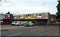
Small shopping centre, Valley View, Sandhurst
Image: © JThomas
Taken: 28 Jul 2022
0.09 miles
2
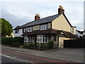
The former Dukes Head on High Street (A321), Sandhurst
Closed in 2014 - now a private residence.
Image: © JThomas
Taken: 28 Jul 2022
0.12 miles
3

Sign for the former Dukes Head on High Street (A321), Sandhurst
Image: © JThomas
Taken: 28 Jul 2022
0.12 miles
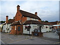
4
The Dukes Head
Pub on Sandhurst High Street
Image: © Richard Croft
Taken: 13 Sep 2011
0.13 miles
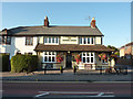
5
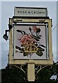
The Rose & Crown, Sandhurst
On High Street.
See Image] for sign.
Image: © JThomas
Taken: 28 Jul 2022
0.14 miles
6
Sign for the Rose & Crown, Sandhurst
See Image] for public house.
Image: © JThomas
Taken: 28 Jul 2022
0.14 miles
7
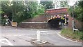
Scotland Hill
From Scotland Hill looking to the High Street bridge at Sandhurst Railway Station
Image: © Shaun Ferguson
Taken: 20 Jun 2019
0.19 miles
8
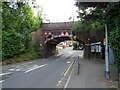
Railway bridge over High Street (A321), Sandhurst
Image: © JThomas
Taken: 28 Jul 2022
0.19 miles
9
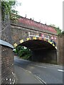
Railway bridge over High Street (A321), Sandhurst
Image: © JThomas
Taken: 28 Jul 2022
0.19 miles
10
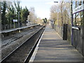
Sandhurst railway station, Berkshire
Opened in 1909 on the South Eastern & Chatham Railway's line from Reading to Redhill.
View north west towards Crowthorne and Reading.
Image: © Nigel Thompson
Taken: 6 Feb 2015
0.20 miles