IMAGES TAKEN NEAR TO
Constable Way, SANDHURST, GU47 0FE
Introduction
This page details the photographs taken nearby to Constable Way, GU47 0FE by members of the Geograph project.
The Geograph project started in 2005 with the aim of publishing, organising and preserving representative images for every square kilometre of Great Britain, Ireland and the Isle of Man.

There are currently over 7.5m images from over14,400 individuals and you can help contribute to the project by visiting https://www.geograph.org.uk
Image Map
Images are licensed for reuse under creativecommons.org/licenses/by-sa/2.0
Notes
- Clicking on the map will re-center to the selected point.
- The higher the marker number, the further away the image location is from the centre of the postcode.
Image Listing (40 Images Found)
Images are licensed for reuse under creativecommons.org/licenses/by-sa/2.0
Image
Details
Distance
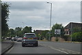
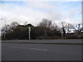
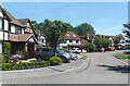
1
Constable Way, Blackwater
On the edge of an area of short residential streets and cul de sacs named after famous artists.
Image: © Des Blenkinsopp
Taken: 18 May 2022
0.07 miles
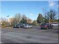
2
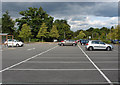
The Meadows car park
Part of the large car park of the Meadows superstore complex built during the 1980s on the edge of Camberley. This land was formerly occupied by a gas works and laundry.
Image: © Alan Hunt
Taken: 29 Aug 2013
0.08 miles
3
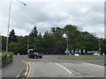
Roundabout on Laundry Lane, College Town
Image: © David Howard
Taken: 17 May 2015
0.09 miles
4
Looking towards the retail park on Marshall Road
Image: © David Howard
Taken: 23 Feb 2015
0.09 miles
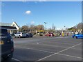
5
The Meadows car park
The car park at the Meadows, at the M&S (north west) end of the superstores. The exit shown exits to a roundabout that leads to Laundry Lane and Yorktown Road, beside Sandhurst Military Academy.
Image: © Oscar
Taken: 26 Feb 2023
0.10 miles
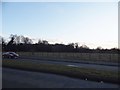
6
The Meadows car park
The car park at the Meadows, at the M&S (north west) end of the superstores.
Image: © Oscar
Taken: 26 Feb 2023
0.11 miles
8
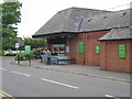
Waitrose superstore, College Town
The superstore was first opened here in 1984/85, as Safeway, though initially with traffic concerns. It ran as Morrisons after the absorbtion of Safeway. It would then convert to Waitrose in 2008. Simultaneously, this was when Waitrose had vacated the Birch Hill store over in Bracknell, to make way for Aldi.
Image: © Sam
Taken: 5 Aug 2017
0.12 miles
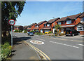
9
Cruickshank Lea, Blackwater
A short street similar to others in this neighbourhood. The timbered Mock Tudor look is very popular.
Image: © Des Blenkinsopp
Taken: 18 May 2022
0.12 miles