
IMAGES TAKEN NEAR TO
Hogmoor Road, BORDON, GU35 9HL
Introduction
This page details the photographs taken nearby to Hogmoor Road, GU35 9HL by members of the Geograph project.
The Geograph project started in 2005 with the aim of publishing, organising and preserving representative images for every square kilometre of Great Britain, Ireland and the Isle of Man.

There are currently over 7.5m images from over14,400 individuals and you can help contribute to the project by visiting https://www.geograph.org.uk
Image Map
Images are licensed for reuse under creativecommons.org/licenses/by-sa/2.0
Notes
- Clicking on the map will re-center to the selected point.
- The higher the marker number, the further away the image location is from the centre of the postcode.
Image Listing (6 Images Found)
Images are licensed for reuse under creativecommons.org/licenses/by-sa/2.0
Image
Details
Distance
2
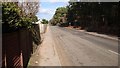
Hogmoor Road
Looking North this straight road sits between Oakhanger and Bordon.
Image: © John P Reeves
Taken: 21 Feb 2019
0.06 miles
3
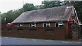
Street lamps and telephone kiosks on Hogmoor Road
Image: © Shazz
Taken: 9 Oct 2009
0.10 miles
4
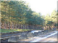
Tank Pit and Track, Hogmoor Road
Taken from Hogmoor Road, this is where a tank road crosses the public road. Note the "dragons teeth" and the long pit beyond them. The heathland lends itself to military training based on Bordon Camp.
Image: © Colin Smith
Taken: 3 Feb 2007
0.12 miles
5
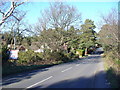
Hogmoor Road, Bordon
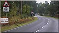
This long, straight road cuts across Bordon Camp. Note the sign on the left. It warns motorists of a "tank crossing" ahead. Other heavy vehicles would also use the track crossing the road.
Image: © Colin Smith
Taken: 3 Feb 2007
0.14 miles
6
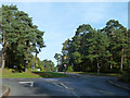
Road junction in the pines
Hogmoor Road meets Oakhanger Road, Bolley Road with the 30 limit is beyond.
Image: © Robin Webster
Taken: 13 Nov 2013
0.21 miles