IMAGES TAKEN NEAR TO
Pelham Close, BORDON, GU35 9DL
Introduction
This page details the photographs taken nearby to Pelham Close, GU35 9DL by members of the Geograph project.
The Geograph project started in 2005 with the aim of publishing, organising and preserving representative images for every square kilometre of Great Britain, Ireland and the Isle of Man.

There are currently over 7.5m images from over14,400 individuals and you can help contribute to the project by visiting https://www.geograph.org.uk
Image Map
Images are licensed for reuse under creativecommons.org/licenses/by-sa/2.0
Notes
- Clicking on the map will re-center to the selected point.
- The higher the marker number, the further away the image location is from the centre of the postcode.
Image Listing (13 Images Found)
Images are licensed for reuse under creativecommons.org/licenses/by-sa/2.0
Image
Details
Distance
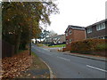
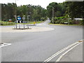
2
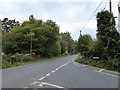
Wandering westwards along the Bashire (11)
Junction of Walldown and Liphook Roads
Running total: 33 B points
Image: © Basher Eyre
Taken: 19 Oct 2016
0.13 miles
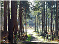
3
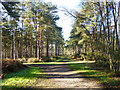
Woodland path, Whitehill
In the strip of MOD land between Liphook Road and the northern boundary of the danger area.
Image: © Robin Webster
Taken: 11 Feb 2016
0.16 miles
4
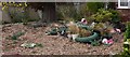
Pigs in Lemon Grove in Whitehill
This is an unusual garden.
Image: © Shazz
Taken: 9 Oct 2009
0.19 miles
5
A lunchtime stroll around Bordon (15)
Looking up Forest Road towards South Hurst
Image: © Basher Eyre
Taken: 16 Nov 2011
0.20 miles
6
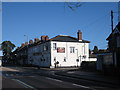
The Roadmaker, Whitehill
Gurkha restaurant, formerly the Prince of Wales pub.
Image: © David960
Taken: 1 Feb 2014
0.20 miles
7
Path on MOD land, Whitehill
This runs down to the boundary track of the danger area of Woolmer Forest. A red flag is flying, indicating the ranges are in use, so keep out. The boundary track largely follows the course of the old Longmoor Military Railway, which had a loop built for instructional purposes right round the range area.
Image: © Robin Webster
Taken: 11 Feb 2016
0.20 miles
8
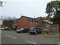
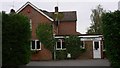
A lunchtime stroll around Bordon (11)
Houses in Overdale Close
Image: © Basher Eyre
Taken: 16 Nov 2011
0.24 miles
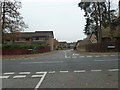
9
Shipwrights' Way 54
The roundabout at the crossing of Petersfield and Liphook Roads is reached and the route goes straight over.
Image: © Shazz
Taken: 21 Aug 2016
0.24 miles
10
A lunchtime stroll around Bordon (12)
Crossroads of Overdale Walk, Forest Road and Alpine Road
Image: © Basher Eyre
Taken: 16 Nov 2011
0.24 miles