
IMAGES TAKEN NEAR TO
Meadow View, BORDON, GU35 0UA
Introduction
This page details the photographs taken nearby to Meadow View, GU35 0UA by members of the Geograph project.
The Geograph project started in 2005 with the aim of publishing, organising and preserving representative images for every square kilometre of Great Britain, Ireland and the Isle of Man.

There are currently over 7.5m images from over14,400 individuals and you can help contribute to the project by visiting https://www.geograph.org.uk
Image Map
Images are licensed for reuse under creativecommons.org/licenses/by-sa/2.0
Notes
- Clicking on the map will re-center to the selected point.
- The higher the marker number, the further away the image location is from the centre of the postcode.
Image Listing (26 Images Found)
Images are licensed for reuse under creativecommons.org/licenses/by-sa/2.0
Image
Details
Distance
1

Newly constructed street at Mill Chase Park
Deadwater Way, named after a local watercourse. Most of the houses in the foreground are sold but not yet occupied. Construction continues behind the photographer, where the street is currently fenced off.
Image: © David Martin
Taken: 23 Aug 2025
0.07 miles
2

New boardwalk Bordon Loop
A new section of boardwalk laid down near Mill Chase road on what will the new Bordon Loop, a 7 mile track suitable for walkers and cyclists
Image: © easthantsxc
Taken: 24 Jan 2015
0.07 miles
3

New housing beside Mill Chase Road
One of the first houses on the Mill Chase Park development, with the show homes and sales centre to the left. Construction continues in the streets behind. See Image
Image: © David Martin
Taken: 23 Aug 2025
0.07 miles
4
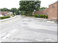
Shipwrights' Way 40
The end of Waterside Close is crossed.
Image: © Shazz
Taken: 21 Aug 2016
0.08 miles
5
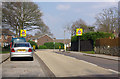
Traffic Calming, Bordon
The road is Chalet Hill or Mill Chase Road - the name changes somewhere around here. It is not a through route to Lindford, although it seems so on the map.
Image: © Robin Webster
Taken: 31 Mar 2007
0.08 miles

7

Looking across Hollybrook Park towards Mercury Close
Image: © Basher Eyre
Taken: 3 Jun 2025
0.09 miles
8
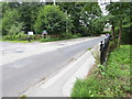
Shipwrights' Way 41
Dead Water is crossed and the Local Nature Reserve is on the left.
Image: © Shazz
Taken: 21 Aug 2016
0.09 miles
9
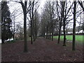
Avenue of trees in Jubilee Park
Jubilee Park, named after the year it was opened, 1977 Queens Silver Jubilee. This avenue of trees runs parallel with Mill Chase Rd
Image: © easthantsxc
Taken: 24 Jan 2016
0.10 miles
