
IMAGES TAKEN NEAR TO
Maynard Way, GU35 0LN
Introduction
This page details the photographs taken nearby to Maynard Way, GU35 0LN by members of the Geograph project.
The Geograph project started in 2005 with the aim of publishing, organising and preserving representative images for every square kilometre of Great Britain, Ireland and the Isle of Man.

There are currently over 7.5m images from over14,400 individuals and you can help contribute to the project by visiting https://www.geograph.org.uk
Image Map
Images are licensed for reuse under creativecommons.org/licenses/by-sa/2.0
Notes
- Clicking on the map will re-center to the selected point.
- The higher the marker number, the further away the image location is from the centre of the postcode.
Image Listing (5 Images Found)
Images are licensed for reuse under creativecommons.org/licenses/by-sa/2.0
Image
Details
Distance
1
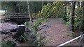
Footbridge over stream at Bordon Camp
This was taken from station road and a large playing field can be glimpsed on the left.
Image: © Shazz
Taken: 9 Oct 2009
0.07 miles
2
Playing fields by Budds Lane, Bordon
Part of the Bordon REME army camp.
Image: © David Howard
Taken: 1 Mar 2015
0.12 miles
3
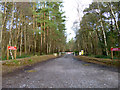
Course of old railway, Bordon
This was the Longmoor Military Railway connection to Bordon station on the branch from Bentley. It described a 180 degree loop ahead to the left before joining the civil line (but with its own platforms) facing the buffer stops at Bordon. The near area was the site of Oakhanger station on the military railway. The connection to Bordon closed with the Bordon branch in 1966, but it is believed Oakhanger remained open, at least in principle, until the military railway closed in 1969.
Image: © Robin Webster
Taken: 30 Jan 2016
0.22 miles
4
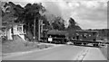
Longmoor Military Railway crossing road at Oakhanger Halt, near Bordon, 1963
View ENE, on the B3002 road near Bordon Camp, the line to the left going to Bordon and a junction with the ex-LSWR branch from Bentley; on the right the line went to Bordon Camp, Longmoor etc., etc. and eventually to Liss on the ex-LSWR main line to Portsmouth. There is a signalbox (freshly painted in Army fashion) on the left, but no crossing-gates. Crossing with a LMR brakevan is a typical WD 0-6-0ST (number not recorded, but probably No. 102 'Caen'). This is in the latter days of the LMR, as it was all closed by October 1969.
Image: © Ben Brooksbank
Taken: 18 Apr 1963
0.24 miles
5
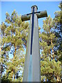
Cross, Bordon Military Cemetery
This peaceful spot is surrounded by Scots Pines. The cross is typical of military cemeteries, forming a focal point. The sword must have copper in it - note the blue stains on the concrete below.
Image: © Colin Smith
Taken: 3 Feb 2007
0.25 miles