IMAGES TAKEN NEAR TO
Paice Lane, ALTON, GU34 5PR
Introduction
This page details the photographs taken nearby to Paice Lane, GU34 5PR by members of the Geograph project.
The Geograph project started in 2005 with the aim of publishing, organising and preserving representative images for every square kilometre of Great Britain, Ireland and the Isle of Man.

There are currently over 7.5m images from over14,400 individuals and you can help contribute to the project by visiting https://www.geograph.org.uk
Image Map
Images are licensed for reuse under creativecommons.org/licenses/by-sa/2.0
Notes
- Clicking on the map will re-center to the selected point.
- The higher the marker number, the further away the image location is from the centre of the postcode.
Image Listing (9 Images Found)
Images are licensed for reuse under creativecommons.org/licenses/by-sa/2.0
Image
Details
Distance
1
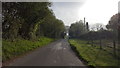
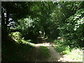
Paice Lane
A minor rural road near to South Town.
Image: © Peter Mackenzie
Taken: 23 Apr 2019
0.02 miles
2
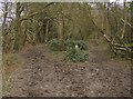
Left or right?
Choice of two footpaths, both very churned up through being used by horses. In a copse near South Town.
Image: © Graham Horn
Taken: 18 Mar 2007
0.15 miles
3
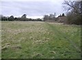
Footpath towards Medstead
Rather scrubby pasture land around this area, with no apparent use.
Image: © Graham Horn
Taken: 18 Mar 2007
0.15 miles
4
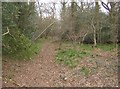
Woodland near South Town
Various paths through this small wood west of the minor road. All seem to be used by horses.
Image: © Graham Horn
Taken: 18 Mar 2007
0.21 miles
5
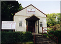
Medstead United Reformed Church
Built in 1896.
Image: © Michael FORD
Taken: Unknown
0.21 miles
6
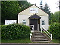
Medstead United Reformed Church
Small church on the west side of South Town Road, Medstead.
http://www.medstead.org/
Image: © Colin Smith
Taken: 21 May 2011
0.21 miles
7
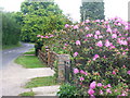
South Town Road
Residential road with large detached dwellings on the southern side of Medstead, a sprawling north-east Hampshire downland village. Rhododendrons are in bloom.
http://www.medstead.org/
Image: © Colin Smith
Taken: 21 May 2011
0.21 miles
8
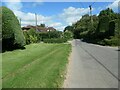
Garden hedges, Soldridge Road
Almost suburban on the outskirts of Medstead, but no pavements.
Image: © Christine Johnstone
Taken: 21 Aug 2023
0.22 miles
9
Knapp Lane, Medstead
A public footpath on a track leading to an area once known as Prior's Nap. This patch of woodland appears to be access land.
Image: © Christine Johnstone
Taken: 21 Aug 2023
0.23 miles