
IMAGES TAKEN NEAR TO
Brightstone Lane, ALTON, GU34 3ET
Introduction
This page details the photographs taken nearby to Brightstone Lane, GU34 3ET by members of the Geograph project.
The Geograph project started in 2005 with the aim of publishing, organising and preserving representative images for every square kilometre of Great Britain, Ireland and the Isle of Man.

There are currently over 7.5m images from over14,400 individuals and you can help contribute to the project by visiting https://www.geograph.org.uk
Image Map
Images are licensed for reuse under creativecommons.org/licenses/by-sa/2.0
Notes
- Clicking on the map will re-center to the selected point.
- The higher the marker number, the further away the image location is from the centre of the postcode.
Image Listing (12 Images Found)
Images are licensed for reuse under creativecommons.org/licenses/by-sa/2.0
Image
Details
Distance
1
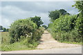
Byway Near Pies Farm, Four Marks, Hampshire
Typical of many byways, a good, wide, track.
Image: © Peter Trimming
Taken: 25 Jul 2009
0.07 miles
2
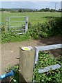
Beside Pies Farm, Lower Farringdon
Where the footpath crosses a farm track.
Image: © Hugh Chevallier
Taken: 19 Sep 2006
0.10 miles

4

View Towards Alton, Hampshire
Alton lies in the valley, and is just about visible towards the left of picture. I presume that my grandparents must have stood and admired this view, as it was less than two miles from their house.
Image: © Peter Trimming
Taken: 25 Jul 2009
0.14 miles
5
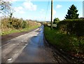
Brightstone Lane
An earlier view is at http://www.geograph.org.uk/photo/1230824.
Image: © Shazz
Taken: 4 Mar 2014
0.16 miles
6
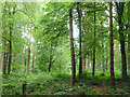
Brightstone Copse
A track into the wood is mapped here, but there is very little sign of it now. It was probably just left of the centre tree.
Image: © Robin Webster
Taken: 15 Jul 2014
0.20 miles
7
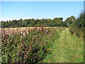
Footpath and farmland, Farringdon
To the left is a field of maize stubble. This is close to the edge of Four Marks but within the parish of Farringdon.
Image: © Andrew Smith
Taken: 27 Sep 2009
0.20 miles
8
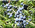
Sloes
Growing beside the St Swithun's Way. They look grape-like, but even after a hot summer are too bitter to eat. Better used for flavouring gin - or making sloe cheese.
Image: © Hugh Chevallier
Taken: 19 Sep 2006
0.22 miles
9
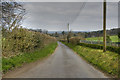
Looking Down Brightstone Lane, Four Marks
This lane links Telegraph Lane, Four Marks to the Gosport Road (A32) at Lower Farringdon.
Image: © HackBitz
Taken: 1 Apr 2009
0.22 miles
10
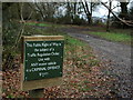
New sign at top of Woodside Lane
The unmetalled section of Woodside Lane has recently been closed to motor vehicles and signs erected.
Image: © Aidan Simons
Taken: 24 Mar 2008
0.23 miles