
IMAGES TAKEN NEAR TO
Chawton Park Road, ALTON, GU34 1RG
Introduction
This page details the photographs taken nearby to Chawton Park Road, GU34 1RG by members of the Geograph project.
The Geograph project started in 2005 with the aim of publishing, organising and preserving representative images for every square kilometre of Great Britain, Ireland and the Isle of Man.

There are currently over 7.5m images from over14,400 individuals and you can help contribute to the project by visiting https://www.geograph.org.uk
Image Map
Images are licensed for reuse under creativecommons.org/licenses/by-sa/2.0
Notes
- Clicking on the map will re-center to the selected point.
- The higher the marker number, the further away the image location is from the centre of the postcode.
Image Listing (35 Images Found)
Images are licensed for reuse under creativecommons.org/licenses/by-sa/2.0
Image
Details
Distance
1
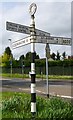
Direction Sign - Signpost by the A339, Whitedown Lane, The Butts
Annulus finial - 4 arms; Hampshire Parish halo by the A339, in parish of Alton (East Hampshire District), at The Butts, on a grass triangle on the west side of the junction of the A339 Whitedown Lane and Chawton Park Road. The A339; SELBORNE 4 / LISS 8 arm was broken off some time after May 2022.
Surveyed
Milestone Society National ID: HA_SU7138
Image: © Milestone Society
Taken: 1 Jan 2015
0.05 miles
3
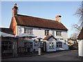
The French Horn, Alton
Popular pub on Whitedown Road, beside the Butts, in western Alton.
Image: © Colin Smith
Taken: 1 Feb 2012
0.05 miles
4
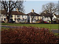
Butts Road, Alton
Residential cul-de-sac in western Alton facing The Butts, an area of parkland where archery was once practised.
Image: © Colin Smith
Taken: 1 Feb 2012
0.06 miles
5
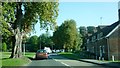
The Butts at Whitedown Lane, Alton
Whitedown Lane is the A339. The French Horn public house is just out of view on the right; railway line and bridge are visible here in mid-distance to the left.
Image: © Clint Mann
Taken: 2 Oct 2015
0.07 miles
6
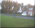
The French Horn
A nice pub on the edge of the Butts.
Image: © Graham Clutton
Taken: 25 Dec 2005
0.07 miles
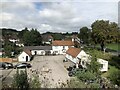
8
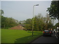
Whitedown Lane, Alton
The Mid-Hants railway runs over the bridge to terminate in Alresford
Image: © David Howard
Taken: 21 May 2012
0.07 miles
9
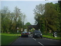
Approaching Butts Bridge, Alton
Butts Bridge is on the Mid-Hants Railway or Watercress Line, linking the end of the official railway in Alton with Alresford, opening in the main tourist seasons and occasional special event days.
Image: © David Howard
Taken: 21 May 2012
0.08 miles
10

The Butts, from Chawton Park Road Alton
Image: © Chris Gunns
Taken: 12 Aug 2009
0.09 miles