IMAGES TAKEN NEAR TO
Hawkley Road, LISS, GU33 6JP
Introduction
This page details the photographs taken nearby to Hawkley Road, GU33 6JP by members of the Geograph project.
The Geograph project started in 2005 with the aim of publishing, organising and preserving representative images for every square kilometre of Great Britain, Ireland and the Isle of Man.

There are currently over 7.5m images from over14,400 individuals and you can help contribute to the project by visiting https://www.geograph.org.uk
Image Map
Images are licensed for reuse under creativecommons.org/licenses/by-sa/2.0
Notes
- Clicking on the map will re-center to the selected point.
- The higher the marker number, the further away the image location is from the centre of the postcode.
Image Listing (16 Images Found)
Images are licensed for reuse under creativecommons.org/licenses/by-sa/2.0
Image
Details
Distance
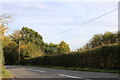
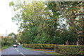
2
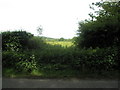
View through the hedge in Hawkley Road
Opposite Lyss Place.
Image: © Basher Eyre
Taken: 23 May 2009
0.07 miles
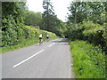
3
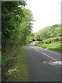
Hawkley Road (2)
Just past Highbrook Stables.
Image: © Basher Eyre
Taken: 23 May 2009
0.07 miles
5
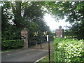
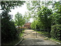
Entrance to Highbrook Hall at Lyss Place
Image: © Basher Eyre
Taken: 23 May 2009
0.08 miles
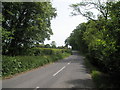
7
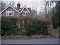
Woodbine Cottage
This is on Hawkley Road west of Liss.
Image: © Shazz
Taken: 31 Dec 2010
0.12 miles
10
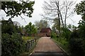
Lyss Place
Parts date from the C.14, there are also the remains of monastic manorhouse and fishponds. It's also reputed to have priest's escape tunnel to Wheatham Hill Farm
Image: © Martyn Pattison
Taken: 18 May 2005
0.17 miles