IMAGES TAKEN NEAR TO
Stairs Hill, LISS, GU33 6HP
Introduction
This page details the photographs taken nearby to Stairs Hill, GU33 6HP by members of the Geograph project.
The Geograph project started in 2005 with the aim of publishing, organising and preserving representative images for every square kilometre of Great Britain, Ireland and the Isle of Man.

There are currently over 7.5m images from over14,400 individuals and you can help contribute to the project by visiting https://www.geograph.org.uk
Image Map
Images are licensed for reuse under creativecommons.org/licenses/by-sa/2.0
Notes
- Clicking on the map will re-center to the selected point.
- The higher the marker number, the further away the image location is from the centre of the postcode.
Image Listing (14 Images Found)
Images are licensed for reuse under creativecommons.org/licenses/by-sa/2.0
Image
Details
Distance
1
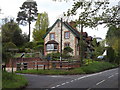
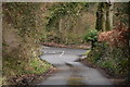
Empshott Road End
Church Lane leaves the main road and heads for historic Empshott Church.
http://www.hawkley.org/empshott/index.html
Image: © Colin Smith
Taken: 16 May 2012
0.05 miles
4
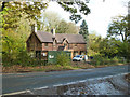
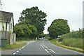
Former Empshott post office and village stores
This seems an unlikely looking building and situation for the village hub. It now appears to be a private house, and is being extended to the right - the slightly lighter wall tiles show the extension.
Image: © Robin Webster
Taken: 16 Nov 2013
0.08 miles
8
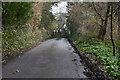
Seasonal Byway
Muddy BOAT at Empshott where the lane is now open to wheeled traffic again. However, recent heavy rain renders the way more liable to erosion.
http://www.hawkley.org/empshott/index.html
Image: © Colin Smith
Taken: 16 May 2012
0.11 miles