IMAGES TAKEN NEAR TO
Henley Park, Pirbright Road, GUILDFORD, GU3 2AD

Introduction

This page details the photographs taken nearby to Henley Park, Pirbright Road, GU3 2AD by members of the Geograph project.

The Geograph project started in 2005 with the aim of publishing, organising and preserving representative images for every square kilometre of Great Britain, Ireland and the Isle of Man.

There are currently over 7.5m images from over14,400 individuals and you can help contribute to the project by visiting https://www.geograph.org.uk

Image Map


Images are licensed for reuse under creativecommons.org/licenses/by-sa/2.0
Notes
  • Clicking on the map will re-center to the selected point.
  • The higher the marker number, the further away the image location is from the centre of the postcode.

Image Listing (29 Images Found)

Images are licensed for reuse under creativecommons.org/licenses/by-sa/2.0
  • ...
Image
Details
Distance
1
Vokes works, Normandy
Vokes, manufacturers of air and oil filtration equipment, moved to the Surrey countryside when their factory in London was destroyed in a bombing raid in World War II, taking over Henley Park mansion. In 1958 Vokes built themselves this large factory and office block in front of the mansion on the A324 Pirbright to Ash road (which has almost inevitably acquired the unofficial tag of "The Vokes Road"). However, the company has recently been taken over and its Henley Park site has been sold to a firm of property developers.
Image: © Ron Strutt Taken: 24 Sep 2005
0.03 miles
2
Trees on edge of Henley Park, A324
Image: © David Howard Taken: 15 Feb 2009
0.05 miles
3
A324 eastbound at Henley Park roundabout
Image: © David Howard Taken: 15 Feb 2009
0.06 miles
4
Trees by Henley Park roundabout, A324 Normandy
Image: © David Howard Taken: 15 Feb 2009
0.06 miles
5
Roundabout to Henley Business Park on A324
Image: © David Howard Taken: 15 Feb 2009
0.06 miles
6
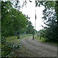
Looking into Danger Area
The red flag is up.
Image: © Shazz Taken: 4 Aug 2014
0.07 miles
7
Ash Ranges perimeter road
The perimeter road around the range fence in an area marked on the maps as Slyfield Wood which has now been cleared back to open heath.
Image: © Alan Hunt Taken: 30 Jul 2014
0.07 miles
8
Entrance to Military Road running parallel to the A324
Image: © James Emmans Taken: 17 Apr 2016
0.07 miles
9
A324 Pirbright Road
Towards Pirbright.
Image: © Robin Webster Taken: 2 Aug 2020
0.09 miles
10
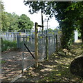
Footpath goes south from the A324 beside electricity substation
Image: © Shazz Taken: 4 Aug 2014
0.09 miles
  • ...