IMAGES TAKEN NEAR TO
Priors Dean, PETERSFIELD, GU32 1BS
Introduction
This page details the photographs taken nearby to GU32 1BS by members of the Geograph project.
The Geograph project started in 2005 with the aim of publishing, organising and preserving representative images for every square kilometre of Great Britain, Ireland and the Isle of Man.

There are currently over 7.5m images from over14,400 individuals and you can help contribute to the project by visiting https://www.geograph.org.uk
Image Map
Images are licensed for reuse under creativecommons.org/licenses/by-sa/2.0
Notes
- Clicking on the map will re-center to the selected point.
- The higher the marker number, the further away the image location is from the centre of the postcode.
Image Listing (19 Images Found)
Images are licensed for reuse under creativecommons.org/licenses/by-sa/2.0
Image
Details
Distance
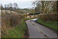
8
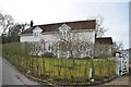
Church Farm, Priors Dean
Church Farm farmhouse with hornbeam hedging (http://www.ashridgetrees.co.uk/Hornbeam-Hedging ) in front of house.
Image: © Adrian Dzienniak
Taken: 3 Jul 2009
0.12 miles
10
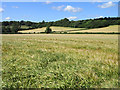
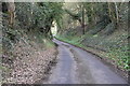
Barley, Priors Dean
Looking down from the road south of Church Farm.
Image: © Andrew Smith
Taken: 5 Jul 2009
0.16 miles