IMAGES TAKEN NEAR TO
Moggs Mead, PETERSFIELD, GU31 4NX
Introduction
This page details the photographs taken nearby to Moggs Mead, GU31 4NX by members of the Geograph project.
The Geograph project started in 2005 with the aim of publishing, organising and preserving representative images for every square kilometre of Great Britain, Ireland and the Isle of Man.

There are currently over 7.5m images from over14,400 individuals and you can help contribute to the project by visiting https://www.geograph.org.uk
Image Map
Images are licensed for reuse under creativecommons.org/licenses/by-sa/2.0
Notes
- Clicking on the map will re-center to the selected point.
- The higher the marker number, the further away the image location is from the centre of the postcode.
Image Listing (260 Images Found)
Images are licensed for reuse under creativecommons.org/licenses/by-sa/2.0
Image
Details
Distance
1
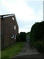
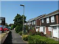
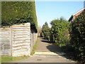
Path from Moggs Mead to River Walk
(which includes a row of houses styled Teg Down)
Image: © Basher Eyre
Taken: 7 Jun 2022
0.00 miles
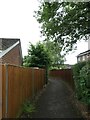
2
That one's doing more than 30!
Taken from the footpath to Long Down as it enters Moggs Mead, which sadly often resembles a race track
Image: © Basher Eyre
Taken: 7 Jun 2022
0.02 miles
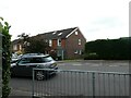
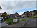
3
Scaffolding on a Herne Farm home
Taken at the junction of Moggs Mead and Long Down. This year 37,033 photos have been submitted to the site of which 137 are mine (0.37%) of the total.
Image: © Basher Eyre
Taken: 11 Mar 2023
0.02 miles
5
33C on 40plus day
Note the sun blockers on the windows on a house in Teg Down on a sweltering July afternoon, the day when the UK temperature record went above 40° for the first time https://www.metoffice.gov.uk/about-us/press-office/news/weather-and-climate/2022/red-extreme-heat-warning-ud#:~:text=For%20the%20first%20time%20on,2019%20by%201.5%C2%B0C.
Image: © Basher Eyre
Taken: 19 Jul 2022
0.03 miles
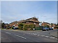
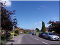
6
2016: a year on Geograph (Day 301)
Junction of Lower Wardown and Moggs Mead. Through the road works you can see the entrance to Long Down
Image: © Basher Eyre
Taken: 27 Oct 2016
0.03 miles
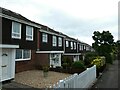
10
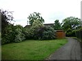
Mature foliage
It is difficult to describe to anyone who has known Herne Farm since its inception how bare it looked at first. No longer!
Image: © Basher Eyre
Taken: 18 Feb 2008
0.04 miles