IMAGES TAKEN NEAR TO
Bolinge Hill, PETERSFIELD, GU31 4NL
Introduction
This page details the photographs taken nearby to Bolinge Hill, GU31 4NL by members of the Geograph project.
The Geograph project started in 2005 with the aim of publishing, organising and preserving representative images for every square kilometre of Great Britain, Ireland and the Isle of Man.

There are currently over 7.5m images from over14,400 individuals and you can help contribute to the project by visiting https://www.geograph.org.uk
Image Map
Images are licensed for reuse under creativecommons.org/licenses/by-sa/2.0
Notes
- Clicking on the map will re-center to the selected point.
- The higher the marker number, the further away the image location is from the centre of the postcode.
Image Listing (27 Images Found)
Images are licensed for reuse under creativecommons.org/licenses/by-sa/2.0
Image
Details
Distance
2
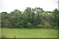
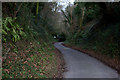
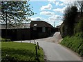
Petersfield Road
This is an unclassified road linking Petersfield to Buriton and beyond
Image: © David Howard
Taken: 30 Apr 2012
0.06 miles
3
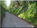
Petersfield Road
This is an unclassified road linking Petersfield to Buriton and beyond
Image: © David Howard
Taken: 30 Apr 2012
0.10 miles
4
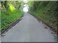
Petersfield Road near the B2070 junction
Image: © Robert Eva
Taken: 14 Jan 2017
0.10 miles
5
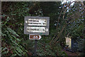
Direction sign on the Petersfield Road
This is at the junction of Petersfield Road and The Causeway (B2070)
Image: © Robert Eva
Taken: 14 Jan 2017
0.11 miles
6
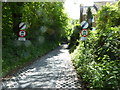
Shipwrights' Way 134
The route has left the B2070 to go to Buriton.
See also http://www.geograph.org.uk/photo/5259469.
Image: © Shazz
Taken: 14 May 2017
0.12 miles
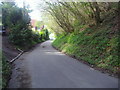
7
Petersfield Road looking south from The Causeway
Image: © Robert Eva
Taken: 14 Jan 2017
0.12 miles
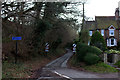
9
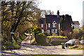
House at the junction of The Causeway and Petersfield Road
Petersfield Road goes to Buriton, for several years it has been signposted as a no through road for vehicles though the road is fully open, I suspect this is to avoid people using it as a "rat run".
Image: © Martyn Pattison
Taken: 4 Apr 2020
0.15 miles