IMAGES TAKEN NEAR TO
The Mead, LIPHOOK, GU30 7AU

Introduction

This page details the photographs taken nearby to The Mead, GU30 7AU by members of the Geograph project.

The Geograph project started in 2005 with the aim of publishing, organising and preserving representative images for every square kilometre of Great Britain, Ireland and the Isle of Man.

There are currently over 7.5m images from over14,400 individuals and you can help contribute to the project by visiting https://www.geograph.org.uk

Image Map


Images are licensed for reuse under creativecommons.org/licenses/by-sa/2.0
Notes
  • Clicking on the map will re-center to the selected point.
  • The higher the marker number, the further away the image location is from the centre of the postcode.

Image Listing (11 Images Found)

Images are licensed for reuse under creativecommons.org/licenses/by-sa/2.0
Image
Details
Distance
1
2016: a year on Geograph (Day 18)
Houses in The Mead, Liphook
Image: © Basher Eyre Taken: 18 Jan 2016
0.04 miles
2
2020 vision: Day 298
Shops in Headley Road Temperature 12C BBC Radio Five Live, 9am news bulletin, first headline: the footballer Marcus Rashford has said he is "proud to be British" after a surge of support from councils and businesses to provide free school meals for disadvantaged children during next week's half-term.
Image: © Basher Eyre Taken: 24 Oct 2020
0.12 miles
3
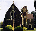
The Immaculate Conception, Liphook
Built in 1911.
Image: © Michael FORD Taken: Unknown
0.13 miles
4
The Immaculate RC Church, Liphook: presbytery
Image: © Basher Eyre Taken: 18 Jan 2016
0.13 miles
5
The Immaculate RC Church, Liphook: mid January 2016
Image: © Basher Eyre Taken: 18 Jan 2016
0.14 miles
6
Houses in Avenue Close
Image: © Basher Eyre Taken: 23 May 2023
0.16 miles
7
A3 northbound
Image: © Alex McGregor Taken: 26 Jun 2012
0.20 miles
8
Radford Aqueduct
This is a scheduled ancient monument. It was once thought to be a pack horse bridge, but was later identified as an aqueduct formerly carrying a leat in a system of irrigation for water meadows along the River Wey, which is crossed here. Mid 17th century, restored in the 1970s. It is beside the later road bridge for the old London Road, now bypassed. There is a very helpful information board nearby.
Image: © Robin Webster Taken: 31 Dec 2015
0.22 miles
9
Street Art Liphook
Under the bridge on London Rd at Radford Park. Drawn in 1988 according to the artwork.
Image: © easthantsxc Taken: 26 Jan 2007
0.22 miles
10
A3
The A3 where the B3004 crosses it at the edge of Liphook.
Image: © Ben Gamble Taken: 23 Jul 2005
0.23 miles