Radford Aqueduct
Introduction
The photograph on this page of Radford Aqueduct by Robin Webster as part of the Geograph project.
The Geograph project started in 2005 with the aim of publishing, organising and preserving representative images for every square kilometre of Great Britain, Ireland and the Isle of Man.

There are currently over 7.5m images from over 14,400 individuals and you can help contribute to the project by visiting https://www.geograph.org.uk
Radford Aqueduct
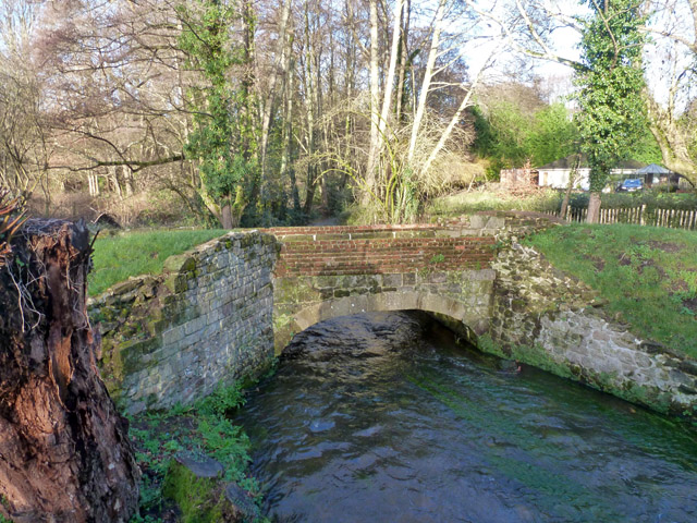
Image: © Robin Webster Taken: 31 Dec 2015
This is a scheduled ancient monument. It was once thought to be a pack horse bridge, but was later identified as an aqueduct formerly carrying a leat in a system of irrigation for water meadows along the River Wey, which is crossed here. Mid 17th century, restored in the 1970s. It is beside the later road bridge for the old London Road, now bypassed. There is a very helpful information board nearby.
Images are licensed for reuse under creativecommons.org/licenses/by-sa/2.0
Image Location
Latitude
51.083583
Longitude
-0.799569