IMAGES TAKEN NEAR TO
Byrefield Road, GUILDFORD, GU2 9UA
Introduction
This page details the photographs taken nearby to Byrefield Road, GU2 9UA by members of the Geograph project.
The Geograph project started in 2005 with the aim of publishing, organising and preserving representative images for every square kilometre of Great Britain, Ireland and the Isle of Man.

There are currently over 7.5m images from over14,400 individuals and you can help contribute to the project by visiting https://www.geograph.org.uk
Image Map
Images are licensed for reuse under creativecommons.org/licenses/by-sa/2.0
Notes
- Clicking on the map will re-center to the selected point.
- The higher the marker number, the further away the image location is from the centre of the postcode.
Image Listing (17 Images Found)
Images are licensed for reuse under creativecommons.org/licenses/by-sa/2.0
Image
Details
Distance
2
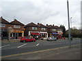
Shops and flats, Worplesdon Road, Guildford
Image: © Stacey Harris
Taken: 6 Apr 2012
0.16 miles
3
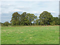
Fields west of Stoughton
The fields west of the housing estates of Stoughton with the tree line surrounding the fishing lake. This area is set to become part of the Stoughton housing estates.
Image: © Alan Hunt
Taken: 28 Sep 2014
0.16 miles
4
Chitty's Common
The open area at the southern end of Chitty's Common, a small reserve managed by Surrey Wildlife Trust.
Image: © Alan Hunt
Taken: 25 Jun 2011
0.16 miles
5
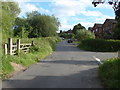
Rides Hill Road
Looking south along Rides Hill Road with the entrance to Chitty's Common on the left and Rides Hill Crescent on the right.
Image: © Alan Hunt
Taken: 25 Jun 2011
0.17 miles
7
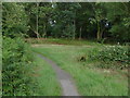
Chitty's Common
The path that runs across Chitty's Common from Rides Hill Road to Bryanston Avenue.
Image: © Alan Hunt
Taken: 25 Jun 2011
0.18 miles
8
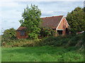
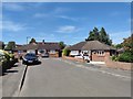
Holly Farm, Stoughton
One of the outbuildings of this former farm, now a private residence.
Image: © Alan Hunt
Taken: 28 Sep 2014
0.18 miles
9
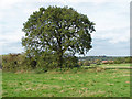
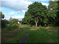
View across the fields near Stoughton
The view north from near Holly Farm. The oak may survive but the fields are designated for housing.
Image: © Alan Hunt
Taken: 28 Sep 2014
0.19 miles
10
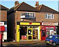
The Local, 145 Worplesdon Road, Stoughton, Guildford
The Local was one of the brand names used by First Quench Retailing Limited, who went into administration in late 2009. Other brands included the better known Threshers, and Victoria Wines. The off-licence here in Worplesdon Road, was one of the first to close following administration. When photographed, in late November 2009, only the shelving remained, and the lease was up for sale. Before this became The Local, Unwins Wine Merchants used to trade here.
Image: © P L Chadwick
Taken: 28 Nov 2009
0.19 miles