
IMAGES TAKEN NEAR TO
Brookfield Lane, PETWORTH, GU28 9BJ
Introduction
This page details the photographs taken nearby to Brookfield Lane, GU28 9BJ by members of the Geograph project.
The Geograph project started in 2005 with the aim of publishing, organising and preserving representative images for every square kilometre of Great Britain, Ireland and the Isle of Man.

There are currently over 7.5m images from over14,400 individuals and you can help contribute to the project by visiting https://www.geograph.org.uk
Image Map
Images are licensed for reuse under creativecommons.org/licenses/by-sa/2.0
Notes
- Clicking on the map will re-center to the selected point.
- The higher the marker number, the further away the image location is from the centre of the postcode.
Image Listing (12 Images Found)
Images are licensed for reuse under creativecommons.org/licenses/by-sa/2.0
Image
Details
Distance
1
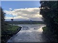
The A272 at Brookfield Lane
The junction of Brookfield Lane with the main road.
Image: © Chris Thomas-Atkin
Taken: 9 Dec 2018
0.02 miles
2
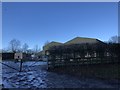
Building at River Farms
The purpose of this building at River Farms was not evident.
Image: © Chris Thomas-Atkin
Taken: 9 Dec 2018
0.05 miles
3
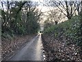
Heading to the A272
Heading southwards on Brookfield Lane and approaching the A272.
Image: © Chris Thomas-Atkin
Taken: 9 Dec 2018
0.06 miles
4
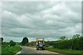
Tractor and trailer on A272
A covered trailer of vegetables heads east on the A272. Where this one was bound for was not investigated, but often in the past several of these at intervals have been noticed taking a route from these parts via Petworth to grind slowly up the steep hill climbing the South Downs on the A282.
Image: © Robin Webster
Taken: 11 May 2012
0.09 miles
5
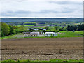
Mobile homes off Brookfield Lane
They appear to be associated with the buildings beyond, which are something to do with agricultural processing or packing.
Image: © Robin Webster
Taken: 11 May 2012
0.09 miles
6
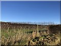
Roadside on the A272
Beyond the fence lies an extensive vineyard.
Image: © Chris Thomas-Atkin
Taken: 9 Dec 2018
0.12 miles
7
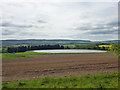
Reservoir near Halfway Bridge
This is of no great age and appears to be for irrigation.
Image: © Robin Webster
Taken: 11 May 2012
0.12 miles
9

Farmland south of the A272 between Midhurst and Petworth
Image: © David Martin
Taken: 27 Jul 2013
0.17 miles
10
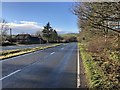
Dual Carriageway on the A272
A short section of dual carriageway on the A272 near Halfway Bridge. The road was unusually quiet at the time.
Image: © Chris Thomas-Atkin
Taken: 9 Dec 2018
0.22 miles