IMAGES TAKEN NEAR TO
Kingsley Green, HASLEMERE, GU27 3LG
Introduction
This page details the photographs taken nearby to GU27 3LG by members of the Geograph project.
The Geograph project started in 2005 with the aim of publishing, organising and preserving representative images for every square kilometre of Great Britain, Ireland and the Isle of Man.

There are currently over 7.5m images from over14,400 individuals and you can help contribute to the project by visiting https://www.geograph.org.uk
Image Map (Loading...)


Getting Data...Please wait
Leaflet Map data © OpenStreetMap
Images are licensed for reuse under creativecommons.org/licenses/by-sa/2.0
Notes
- Clicking on the map will re-center to the selected point.
- The higher the marker number, the further away the image location is from the centre of the postcode.
Image Listing (15 Images Found)
Images are licensed for reuse under creativecommons.org/licenses/by-sa/2.0
Image
Details
Distance
1
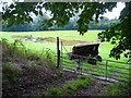
Pond in field with gate and farm machinery
This is in the north west corner of West Sussex, at Marley Heights.
Image: © Shazz
Taken: 22 Sep 2008
0.13 miles
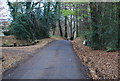
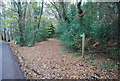
3
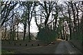
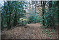
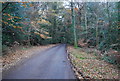
Woodland Hanger
Marley Lane across Woodland Hanger, an extension of Marley Common at its south-east corner. The common is part-owned by the National Trust. To the left is a subsidiary drive to Rosemary Park.
Image: © Hugh Craddock
Taken: 1 Jan 2013
0.17 miles