
IMAGES TAKEN NEAR TO
Birch Platt, WOKING, GU24 9NR
Introduction
This page details the photographs taken nearby to Birch Platt, GU24 9NR by members of the Geograph project.
The Geograph project started in 2005 with the aim of publishing, organising and preserving representative images for every square kilometre of Great Britain, Ireland and the Isle of Man.

There are currently over 7.5m images from over14,400 individuals and you can help contribute to the project by visiting https://www.geograph.org.uk
Image Map
Images are licensed for reuse under creativecommons.org/licenses/by-sa/2.0
Notes
- Clicking on the map will re-center to the selected point.
- The higher the marker number, the further away the image location is from the centre of the postcode.
Image Listing (14 Images Found)
Images are licensed for reuse under creativecommons.org/licenses/by-sa/2.0
Image
Details
Distance
1
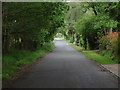
Brentmoor Road
Looking along Brentmoor Road which runs from the A322, the Guildford Road to the edge of the Pirbright range.
Image: © Alan Hunt
Taken: 18 Jun 2012
0.09 miles
2
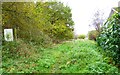
Footpath from Brentmoor Road
The notice declares this is a nature reserve and states "NO HORSES". The rest is illegible.
Image: © Shazz
Taken: 13 Nov 2014
0.11 miles
4
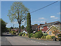
Broad Street, West End
The cul-de-sac ending in the Brentmoor Heath car park. There is a telegraph pole under all that ivy!
Image: © Alan Hunt
Taken: 7 May 2013
0.14 miles
5

Looking west on Brentmoor Road from Birch Lane
A different view with the telephone box from 2013 is at http://www.geograph.org.uk/photo/3450074.
Image: © Shazz
Taken: 13 Nov 2014
0.15 miles
6

Brentmoor Road, West End
Looking east along Brentmoor Road with the phone box on the corner of Birch Lane on the left and the Fenns Lane junction on the right.
Image: © Alan Hunt
Taken: 8 Nov 2015
0.17 miles
7

Brentmoor Road
The 1960s housing estate in the area known as Donkey Town in West End.
Image: © Alan Hunt
Taken: 7 May 2013
0.17 miles

9

Fenns Lane, West End
The parish noticeboard at the junction of Fenns Lane with Brentmoor Road.
Image: © Alan Hunt
Taken: 8 Nov 2015
0.20 miles
10
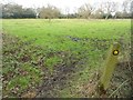
West End: Footpath between Lucas Green and Donkey Town (3)
This is viewed just north of the footbridge taking the footpath over Trulley Brook, looking towards Donkey Town. The route of the footpath is indistinct, but goes to the first singular tree and then slightly right to the far hedgeline.
Image: © Nigel Cox
Taken: 28 Feb 2016
0.21 miles