
IMAGES TAKEN NEAR TO
Elveden Close, WOKING, GU22 8XA
Introduction
This page details the photographs taken nearby to Elveden Close, GU22 8XA by members of the Geograph project.
The Geograph project started in 2005 with the aim of publishing, organising and preserving representative images for every square kilometre of Great Britain, Ireland and the Isle of Man.

There are currently over 7.5m images from over14,400 individuals and you can help contribute to the project by visiting https://www.geograph.org.uk
Image Map
Images are licensed for reuse under creativecommons.org/licenses/by-sa/2.0
Notes
- Clicking on the map will re-center to the selected point.
- The higher the marker number, the further away the image location is from the centre of the postcode.
Image Listing (36 Images Found)
Images are licensed for reuse under creativecommons.org/licenses/by-sa/2.0
Image
Details
Distance
1
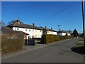
Elvedene Close
Post war council houses built on Elveden Place land in Pyrford Green.
Image: © James Emmans
Taken: 25 Feb 2018
0.03 miles
2
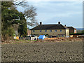
Houses on Elveden Close
A rear view of houses at the end of the close.
Image: © Robin Webster
Taken: 20 Mar 2012
0.05 miles
3
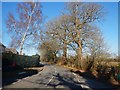
Mature Oaks along Pyrford Road
Minor rural road running past Pyrford Green.
Image: © James Emmans
Taken: 25 Feb 2018
0.08 miles
4
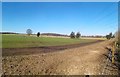
Farmland and Footpath near Pyrford Green
Image: © James Emmans
Taken: 25 Feb 2018
0.08 miles
5
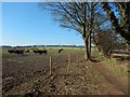
Farmland next to Pyrford Green
Hornbeam next to pastoral farmland.
wikipedia : https://en.wikipedia.org/wiki/Pastoral_farming
Image: © James Emmans
Taken: 25 Feb 2018
0.09 miles
6
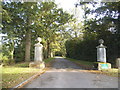
The entrance to Pyrford Manor on Warren Lane
Image: © David Howard
Taken: 5 Oct 2014
0.09 miles
7
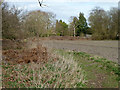
Footpath towards Pyrford Road
Nearly every field edge has a public footpath in this area north of Pyrford Village.
Image: © Robin Webster
Taken: 20 Mar 2012
0.10 miles
8
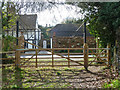
Footpath from Lock Lane reaches Pyrford Road
Image: © Robin Webster
Taken: 20 Mar 2012
0.11 miles
9
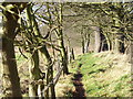
Path West of Pyrford Green
Tree-lined footpath leading away from a residential cul-de-sac.
Image: © Colin Smith
Taken: 29 Dec 2007
0.12 miles
10
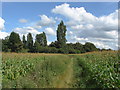
Footpath, Pyrford Green
One of the network of footpaths that run around many of the fields to the east of Pyrford Green. Maize seems to be the predominate crop in this area.
Image: © Alan Hunt
Taken: 14 Aug 2012
0.12 miles