
IMAGES TAKEN NEAR TO
High Street, WOKING, GU21 4SS
Introduction
This page details the photographs taken nearby to High Street, GU21 4SS by members of the Geograph project.
The Geograph project started in 2005 with the aim of publishing, organising and preserving representative images for every square kilometre of Great Britain, Ireland and the Isle of Man.

There are currently over 7.5m images from over14,400 individuals and you can help contribute to the project by visiting https://www.geograph.org.uk
Image Map
Images are licensed for reuse under creativecommons.org/licenses/by-sa/2.0
Notes
- Clicking on the map will re-center to the selected point.
- The higher the marker number, the further away the image location is from the centre of the postcode.
Image Listing (41 Images Found)
Images are licensed for reuse under creativecommons.org/licenses/by-sa/2.0
Image
Details
Distance
1
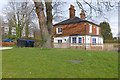
Horsell village
The house next to the village hall on the High Street. The flats on Pares Close can be seen in the background. This is one of the oldest houses in Horsell predating the 1873 edition of the OS.
Image: © Alan Hunt
Taken: 30 Mar 2016
0.00 miles
3
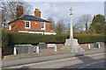
Horsell War Memorial
The War Memorial on the High Street.
Image: © Alan Hunt
Taken: 30 Mar 2016
0.01 miles
4
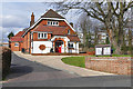
Horsell Village Hall
The Parish Hall off the High Street, dating from the Edwardian era. The flats on Pares Close can be seen in the background.
Image: © Alan Hunt
Taken: 30 Mar 2016
0.01 miles
5
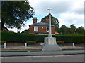
War Memorial, Horsell: early September 2015
Image: © Basher Eyre
Taken: 7 Sep 2015
0.02 miles
6
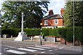
War memorial, Horsell
Horsell was the main settlement of the area when what is now the town of Woking was open heathland.
Image: © Ron Strutt
Taken: 29 Aug 2005
0.02 miles
7
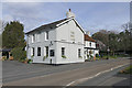
The Red Lion, Horsell
The Red Lion public house on the High Street at the corner of Wilson Way. This inn predates the 1873 edition of the OS.
Image: © Alan Hunt
Taken: 30 Mar 2016
0.03 miles
8
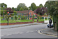
Recreation area, Horsell
The Green along the High Street from the junction with Bury Lane. The building with the white lettering on the gable is the clubhouse of Horsell Bowling Club.
Image: © Alan Hunt
Taken: 14 Sep 2015
0.03 miles
9
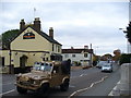
Horsell High Street
Looking from The Crown, north-westwards towards the shops. Horsell has long been engulfed by Woking's suburban sprawl as the town has grown around the main line railway station.
Image: © Colin Smith
Taken: 2 Nov 2007
0.04 miles
10
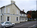
The Red Lion, Horsell
Pub on High Street, Horsell - now part of the Woking built-up area.
Image: © Colin Smith
Taken: 2 Nov 2007
0.04 miles