
IMAGES TAKEN NEAR TO
Red Road, LIGHTWATER, GU18 5UU
Introduction
This page details the photographs taken nearby to Red Road, GU18 5UU by members of the Geograph project.
The Geograph project started in 2005 with the aim of publishing, organising and preserving representative images for every square kilometre of Great Britain, Ireland and the Isle of Man.

There are currently over 7.5m images from over14,400 individuals and you can help contribute to the project by visiting https://www.geograph.org.uk
Image Map
Images are licensed for reuse under creativecommons.org/licenses/by-sa/2.0
Notes
- Clicking on the map will re-center to the selected point.
- The higher the marker number, the further away the image location is from the centre of the postcode.
Image Listing (15 Images Found)
Images are licensed for reuse under creativecommons.org/licenses/by-sa/2.0
Image
Details
Distance
1

Red Road between Lightwater and Camberley
Image: © David Howard
Taken: 27 Jul 2015
0.18 miles
2
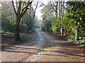
Curley Hill Road
The access road off Macdonald Road that also serves as a byway leading to High Curley.
Image: © Alan Hunt
Taken: 20 Jan 2014
0.19 miles
3
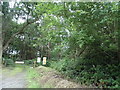
The entrance to Hangmoor Range
This is private MoD property on Surrey Heath
Image: © David Howard
Taken: 27 Jul 2015
0.19 miles
4
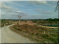
The edge of Surrey Heath
The photo shows the Northern perimeter fence of the Chobham, (Bisley), ranges which are located on Surrey Heathland. To the left of the photo is Red Road, which marks a change in the soil structure from Heathland to Woodland. The road in the photo is the inspection road for the razor wire protected fence, which extends around the 'overshoot' for the ranges.
Image: © Len Williams
Taken: 27 Feb 2009
0.22 miles
6
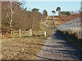
Cattle grid, Pirbright Ranges
A cattle grid on the range track installed to stop the cattle on the Folly Bog from going west.
Image: © Alan Hunt
Taken: 19 Jan 2015
0.22 miles
7
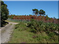
Pirbright Ranges
The fence line south of the Red Road. The red trees are the result of the major fire in May 2010 that came right up to the fence.
Image: © Alan Hunt
Taken: 18 Jul 2010
0.23 miles
9
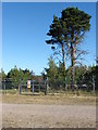
Pirbright Ranges
The gate in the fence line on top of the high ground to the west of the Folly Bog.
Image: © Alan Hunt
Taken: 18 Jul 2010
0.23 miles
10
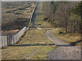
Pirbright Range fence
Looking west along the fenceline towards the Chobham Ridges in the distance.
Image: © Alan Hunt
Taken: 19 Jan 2015
0.23 miles