The edge of Surrey Heath
Introduction
The photograph on this page of The edge of Surrey Heath by Len Williams as part of the Geograph project.
The Geograph project started in 2005 with the aim of publishing, organising and preserving representative images for every square kilometre of Great Britain, Ireland and the Isle of Man.

There are currently over 7.5m images from over 14,400 individuals and you can help contribute to the project by visiting https://www.geograph.org.uk
The edge of Surrey Heath
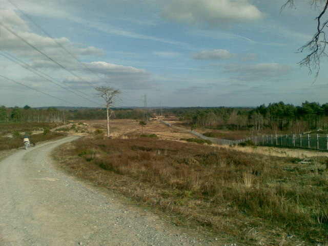
Image: © Len Williams Taken: 27 Feb 2009
The photo shows the Northern perimeter fence of the Chobham, (Bisley), ranges which are located on Surrey Heathland. To the left of the photo is Red Road, which marks a change in the soil structure from Heathland to Woodland. The road in the photo is the inspection road for the razor wire protected fence, which extends around the 'overshoot' for the ranges.
Images are licensed for reuse under creativecommons.org/licenses/by-sa/2.0
Image Location
Latitude
51.340155
Longitude
-0.684342