IMAGES TAKEN NEAR TO
Queensbury Place, CAMBERLEY, GU17 9LX
Introduction
This page details the photographs taken nearby to Queensbury Place, GU17 9LX by members of the Geograph project.
The Geograph project started in 2005 with the aim of publishing, organising and preserving representative images for every square kilometre of Great Britain, Ireland and the Isle of Man.

There are currently over 7.5m images from over14,400 individuals and you can help contribute to the project by visiting https://www.geograph.org.uk
Image Map (Loading...)


Getting Data...Please wait
Leaflet Map data © OpenStreetMap
Images are licensed for reuse under creativecommons.org/licenses/by-sa/2.0
Notes
- Clicking on the map will re-center to the selected point.
- The higher the marker number, the further away the image location is from the centre of the postcode.
Image Listing (21 Images Found)
Images are licensed for reuse under creativecommons.org/licenses/by-sa/2.0
Image
Details
Distance
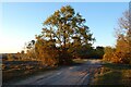
1
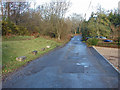
Woodside Road, Blackwater
The military road giving access to the houses on Starve Acre and the Yateley Common MOD training grounds. If anyone is wondering where all the MOD trig markers have gone they are being used as anti-parking devices along the road.
Image: © Alan Hunt
Taken: 19 Dec 2014
0.12 miles
4
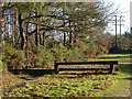
Drag hunt jump, Hawlwy Hill
One of the jumps put in place for the Sandhurst Military Academy's drag hunt.
Image: © Alan Hunt
Taken: 19 Dec 2014
0.13 miles
5
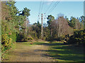
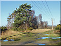
Pylon line, Hawley Hill
The pylon line that runs across Yateley Common and Hawley Hill.
Image: © Alan Hunt
Taken: 19 Dec 2014
0.16 miles
7
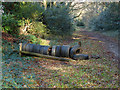
Horse jump, Starve Acre
A tyre horse jump on the track behind the houses on Woodside Road.
Image: © Alan Hunt
Taken: 19 Dec 2014
0.18 miles
8
Heathland, Hawley
The north-eastern part of Hawley Common, close to the edge of Blackwater.
Image: © Andrew Smith
Taken: 22 Apr 2021
0.19 miles
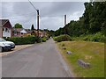
9
Path junction, Yateley Common
A path junction on this large area of lowland heath south of the A30, used by the MOD as a training area.
Image: © Alan Hunt
Taken: 19 Dec 2014
0.20 miles
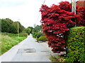
10
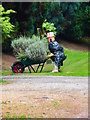
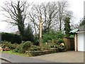
This is number 25
This is a novel numbering system and an unusual gardener.
Image: © Shazz
Taken: 1 Oct 2014
0.20 miles