IMAGES TAKEN NEAR TO
Hawley Road, CAMBERLEY, GU17 9EH
Introduction
This page details the photographs taken nearby to Hawley Road, GU17 9EH by members of the Geograph project.
The Geograph project started in 2005 with the aim of publishing, organising and preserving representative images for every square kilometre of Great Britain, Ireland and the Isle of Man.

There are currently over 7.5m images from over14,400 individuals and you can help contribute to the project by visiting https://www.geograph.org.uk
Image Map
Images are licensed for reuse under creativecommons.org/licenses/by-sa/2.0
Notes
- Clicking on the map will re-center to the selected point.
- The higher the marker number, the further away the image location is from the centre of the postcode.
Image Listing (94 Images Found)
Images are licensed for reuse under creativecommons.org/licenses/by-sa/2.0
Image
Details
Distance
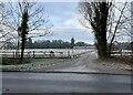
2
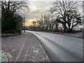
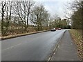
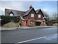
Hawley Road looking northwest from the entrance to Hawley Lodge
Image: © Shazz
Taken: 20 Jun 2012
0.05 miles
5
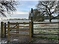
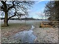
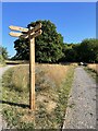
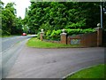
Access to Hawley Farm Open Space
A recently created public park out of land that was once part of Hawley Park Farm.
Image: © Fernweh
Taken: 19 Jan 2023
0.06 miles