1
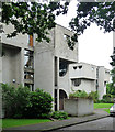
Church Road, Frimley
A disused building, part of the Children's Centre in Church Road.
Image: © Alan Hunt
Taken: 7 Feb 2014
0.01 miles
2
Flats on Chantry Court, Frimley
Image: © David Howard
Taken: 7 Jun 2015
0.02 miles
3
Chantry Court, Frimley
Four-storey residential accommodation close to Frimley shopping centre, Frimley Park Hospital and St. Peter's Church.
Image: © Euchiasmus
Taken: 14 May 2014
0.03 miles
4
Frimley Children's Centre
The old cottage hospital is now dedicated to child oriented services.
Image: © Len Williams
Taken: 5 Apr 2012
0.03 miles
5
Signs on Apex Drive, Frimley
There is a story behind the current arrangement of signs. The custom made triangle is not beware of cats (although that is always a good idea), but the plaque below originally had '20's purrfect' underneath. That was replaced by the original warning sign (pre-Worboys) which was originally above it and provided the message on its own, as presumably the speed limit was unofficial and unlawful. Because the old sign is now on a wider part of the lamp post they had to remove the old bracket and replaced it with gardening twine which is not a good idea. Finally the houses may not have been built till the mid 60s, meaning either the road was made a little earlier or the danger sign was taken from a supply after the design had been made obsolete. But a very lucky survivor, one represented in various versions, with caution being a standard alternative, or adding the danger underneath.
Image: © David Howard
Taken: 7 Jun 2015
0.05 miles
6
Burleigh Road, Frimley, looking north
Burleigh Road is a quiet residential road within easy walking distance to Frimley shopping centre, which is why parking is restricted by double yellow lines. This view looks north towards Church Road, the main B3411 leading into Frimley, which can just be seen at the T-junction at the end of the road, beyond the road works. Properties in the road have mature, attractive gardens.
Image: © Euchiasmus
Taken: 19 May 2014
0.06 miles
7
House on Apex Drive, Frimley
Image: © David Howard
Taken: 7 Jun 2015
0.06 miles
8
Apex Drive, Frimley
That rarity in British architecture - a modern housing estate which makes no nods to the past. No fake beams, no ill-fitting porticos, no leaded windows. The development comprises eight blocks, each containing four flats. They are clad in white-grey brick. Built in 1966-69 to the designs of Derek Sharp Associates.
Image: © Stephen Richards
Taken: 9 Jul 2012
0.07 miles
9
House on Apex Drive, Frimley
Although described elsewhere as flats every one I saw appeared to have a single entrance and just very large houses. Here is the main information and with no surprise won an architectural award https://camberleyobserved.wordpress.com/2012/11/23/prize-winning-architecture-in-apex-drive-frimley/
Image: © David Howard
Taken: 7 Jun 2015
0.07 miles
10
Ye Olde White Hart, Frimley
The old coaching house at the junction of Church Road and Frimley High Street.
Image: © Alan Hunt
Taken: 7 Feb 2014
0.07 miles


