Signs on Apex Drive, Frimley
Introduction
The photograph on this page of Signs on Apex Drive, Frimley by David Howard as part of the Geograph project.
The Geograph project started in 2005 with the aim of publishing, organising and preserving representative images for every square kilometre of Great Britain, Ireland and the Isle of Man.

There are currently over 7.5m images from over 14,400 individuals and you can help contribute to the project by visiting https://www.geograph.org.uk
Signs on Apex Drive, Frimley
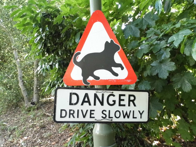
Image: © David Howard Taken: 7 Jun 2015
There is a story behind the current arrangement of signs. The custom made triangle is not beware of cats (although that is always a good idea), but the plaque below originally had '20's purrfect' underneath. That was replaced by the original warning sign (pre-Worboys) which was originally above it and provided the message on its own, as presumably the speed limit was unofficial and unlawful. Because the old sign is now on a wider part of the lamp post they had to remove the old bracket and replaced it with gardening twine which is not a good idea. Finally the houses may not have been built till the mid 60s, meaning either the road was made a little earlier or the danger sign was taken from a supply after the design had been made obsolete. But a very lucky survivor, one represented in various versions, with caution being a standard alternative, or adding the danger underneath.
Images are licensed for reuse under creativecommons.org/licenses/by-sa/2.0
Image Location
Latitude
51.314343
Longitude
-0.741184