IMAGES TAKEN NEAR TO
Deepcut Bridge Road, CAMBERLEY, GU16 6SJ
Introduction
This page details the photographs taken nearby to Deepcut Bridge Road, GU16 6SJ by members of the Geograph project.
The Geograph project started in 2005 with the aim of publishing, organising and preserving representative images for every square kilometre of Great Britain, Ireland and the Isle of Man.

There are currently over 7.5m images from over14,400 individuals and you can help contribute to the project by visiting https://www.geograph.org.uk
Image Map
Images are licensed for reuse under creativecommons.org/licenses/by-sa/2.0
Notes
- Clicking on the map will re-center to the selected point.
- The higher the marker number, the further away the image location is from the centre of the postcode.
Image Listing (21 Images Found)
Images are licensed for reuse under creativecommons.org/licenses/by-sa/2.0
Image
Details
Distance
1
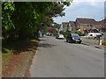
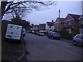
Blackdown Road
The residential road running along the southern side of the Blackdown Hill MOD land
Image: © Alan Hunt
Taken: 17 Apr 2011
0.08 miles
2
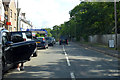
B3015 Deepcut Bridge Road
Passing north through Deepcut.
Image: © Robin Webster
Taken: 9 Jun 2019
0.10 miles
4
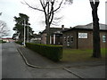
The Royal Logistics Corps Museum
An unassuming building on the Deepcut estate.
Image: © Jonathan Billinger
Taken: 26 Mar 2008
0.11 miles
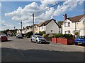
6
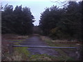
Ministry of Defence land off Blackdown Road
Image: © David Howard
Taken: 11 Jan 2012
0.13 miles
7
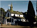
St Barbara, Deepcut
Grade 2 listed building erected in 1900 as a Garrison Church.
Image: © Michael FORD
Taken: Unknown
0.15 miles
8
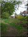
Blackdown Hill training area
The footpath that runs parallel with Blackdown Road, with the houses on Blackdown Road in the background.
Image: © Alan Hunt
Taken: 17 Apr 2011
0.17 miles
9
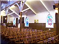
St Barbara's Church
The North wall of St Barbara's church showing some of the beautiful stained glass windows. The window on the right celebrates "All ranks of the RAOC Training Centre", while the middle one celebrates "RAOC serving in BAOR". For a view of the D-Day memorial refer to picture Image
Image: © Len Williams
Taken: 22 Jan 2012
0.22 miles
10
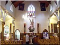
St Barbara's Church
The West wall of St Barbara's church showing the plaster relief of St Michael and the Dragon. The original name of the church was 'St Michael & All Angels' . St Barbara was adopted as the Patron Saint of the Royal Army Ordnance Corps in 1922, and the church was rededicated to St Barbara on 1st October 1967. For another view of the interior refer to picture Image
Image: © Len Williams
Taken: 22 Jan 2012
0.22 miles