
IMAGES TAKEN NEAR TO
Bartlett Place, CAMBERLEY, GU16 6HU
Introduction
This page details the photographs taken nearby to Bartlett Place, GU16 6HU by members of the Geograph project.
The Geograph project started in 2005 with the aim of publishing, organising and preserving representative images for every square kilometre of Great Britain, Ireland and the Isle of Man.

There are currently over 7.5m images from over14,400 individuals and you can help contribute to the project by visiting https://www.geograph.org.uk
Image Map
Images are licensed for reuse under creativecommons.org/licenses/by-sa/2.0
Notes
- Clicking on the map will re-center to the selected point.
- The higher the marker number, the further away the image location is from the centre of the postcode.
Image Listing (27 Images Found)
Images are licensed for reuse under creativecommons.org/licenses/by-sa/2.0
Image
Details
Distance
1
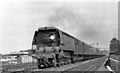
Waterloo - Weymouth express at Sturt Lane Junction
View eastward, towards London: ex-LSW Waterloo - the West main line, east of Farnborough where connection is made - but closed soon after - with the Ascot - Aldershot line. The 13.30 Waterloo - Weymouth express is headed by SR Bulleid 'Merchant Navy' Pacific No. 35027 'Port Line' (built 12/48, subsequently rebuilt 10/59, withdrawn 9/66 but preserved): it is currently on the East Lancashire Railway.
Image: © Ben Brooksbank
Taken: 9 Jul 1955
0.04 miles
2
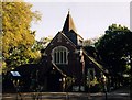
St Andrew, Frimley Green
Grade 2 listed building erected in 1911.
Image: © Michael FORD
Taken: Unknown
0.08 miles
3
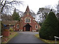
St Andrew's Church, Frimley Green
A 'tin' church was built on this site in 1896 but was replaced with this church in 1912.
Image: © Graham Clutton
Taken: 5 Jan 2006
0.09 miles
4
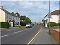
Sturt Road, Frimley Green
The view along Sturt Road looking towards the area of the green.
Image: © Alan Hunt
Taken: 13 Sep 2012
0.09 miles
5
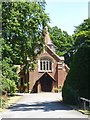
St Andrew's Church, Frimley Green
Built 1911 to designs of architects H.R. and B.A. Poulter. Grade II listed, described at this http://list.historicengland.org.uk/resultsingle.aspx?uid=1188123.
Image: © Jim Osley
Taken: 18 Jun 2015
0.09 miles
6
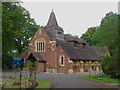
St Andrew's Church, Frimley Green
St Andrew's Church, built in 1912 to replace an earlier church, on Sturt Road.
Image: © Alan Hunt
Taken: 13 Sep 2012
0.10 miles
7
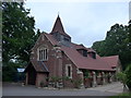
St Andrew, Frimley Green: mid July 2015
Image: © Basher Eyre
Taken: 13 Jul 2015
0.10 miles
8
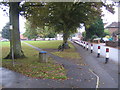
Frimley Green: The Green
Massed ranks of bollards protect Frimley Green's green from traffic on The Green..., which is the lane to the right.
Image: © Nigel Cox
Taken: 2 Oct 2007
0.10 miles
9
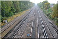
South West main line west of Frimley Green
This is the main line from London Waterloo to Southampton and Weymouth.
Image: © David Martin
Taken: 24 Oct 2019
0.11 miles
10
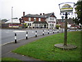
Frimley Green
Frimley Green's village sign features the Bedford Farm Barn, a Grade II listed building in The Hatches that dates from around 1500. Beyond the B3411 Sturt Road is the Rose and Thistle public house.
Image: © Nigel Cox
Taken: 2 Oct 2007
0.13 miles