IMAGES TAKEN NEAR TO
Star Lane, ALDERSHOT, GU12 6RJ
Introduction
This page details the photographs taken nearby to Star Lane, GU12 6RJ by members of the Geograph project.
The Geograph project started in 2005 with the aim of publishing, organising and preserving representative images for every square kilometre of Great Britain, Ireland and the Isle of Man.

There are currently over 7.5m images from over14,400 individuals and you can help contribute to the project by visiting https://www.geograph.org.uk
Image Map (Loading...)


Getting Data...Please wait
Leaflet Map data © OpenStreetMap
Images are licensed for reuse under creativecommons.org/licenses/by-sa/2.0
Notes
- Clicking on the map will re-center to the selected point.
- The higher the marker number, the further away the image location is from the centre of the postcode.
Image Listing (31 Images Found)
Images are licensed for reuse under creativecommons.org/licenses/by-sa/2.0
Image
Details
Distance
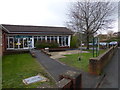
5
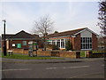
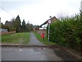
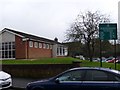
Ash Library, Star Lane, Ash, Surrey
These modern buildings also house local offices of Guildford District Council.
Image: © Humphrey Bolton
Taken: 24 Jan 2006
0.06 miles
6
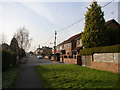
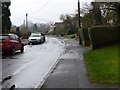
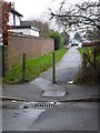
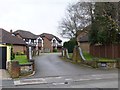
East end of Alexandra Road, Ash, Surrey
This is a residential road that has been extended from the west over the last century until it reached Star Lane. The Star Lane has been blocked to prevent through traffic, and the part beyond the driveways of the last houses is a footway across grass.
Image: © Humphrey Bolton
Taken: 24 Jan 2006
0.06 miles
8
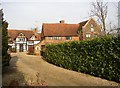
Azor Place, Ash Street, Ash, Surrey
This is my favourite of the old houses of Ash. The cross-wing on the right was an early 18C addition, dated 1717 in large figures in the brickwork (unfortunately hidden by the hedge in this view), and has an attractive sundial. The houses at the end of the drive on the left were converted from a barn in the 1950s, so it would seem that Azor Place was a farmhouse. Azor was the name of the Saxon holder of the manor in the Domesday Book.
Image: © Humphrey Bolton
Taken: 24 Jan 2006
0.09 miles
10
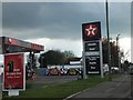
Filling station and car dealer on A323
Image: © David Smith
Taken: 13 Apr 2012
0.09 miles