
IMAGES TAKEN NEAR TO
Alder Close, ALDERSHOT, GU12 5QS
Introduction
This page details the photographs taken nearby to Alder Close, GU12 5QS by members of the Geograph project.
The Geograph project started in 2005 with the aim of publishing, organising and preserving representative images for every square kilometre of Great Britain, Ireland and the Isle of Man.

There are currently over 7.5m images from over14,400 individuals and you can help contribute to the project by visiting https://www.geograph.org.uk
Image Map
Images are licensed for reuse under creativecommons.org/licenses/by-sa/2.0
Notes
- Clicking on the map will re-center to the selected point.
- The higher the marker number, the further away the image location is from the centre of the postcode.
Image Listing (53 Images Found)
Images are licensed for reuse under creativecommons.org/licenses/by-sa/2.0
Image
Details
Distance
1
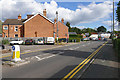
Lysons Avenue, Ash Vale
Looking southeast along Lysons Avenue towards the junction with Vale Road.
Image: © Alan Hunt
Taken: 2 Oct 2016
0.04 miles
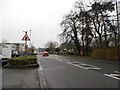
3
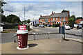
Lysons Avenue, Ash Vale
Along the rather dull walk between Ash Vale and North Camp stations. There are a lot of railway lines around here. They come near each other, even cross over, but don't interchange. At just under 1 kilometre the walk between Ash Vale and North Camp is sort of feasible on a nice day, and is even signposted at the stations.
It's pretty boring though. Cheer yourself up with a cup of coffee.
Image: © Des Blenkinsopp
Taken: 4 Aug 2022
0.05 miles
4
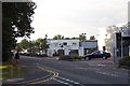
Lysons Avenue industrial units
Lysons Avenue is lined with light industrial units of all shapes, sizes, and designs. In age they range from possibly the 1930s (the white building in the centre) to the ultra-modern (on the right).
Image: © Ron Strutt
Taken: 20 Sep 2005
0.07 miles
5
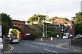
Ash Vale station and bridge
The railway from Woking to Alton via Aldershot crosses the Ash to Frimley road on a high embankment, just by Ash Vale station. The station structure - comprising mostly a staircase leading to the platforms - is a less than elegant structure.
Image: © Ron Strutt
Taken: 20 Sep 2005
0.07 miles
6
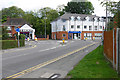
Lysons Avenue, Ash Vale
The junction of Lysons Avenue with Vale Road to the right and Frimley Road to the left.
Image: © Alan Hunt
Taken: 2 Oct 2016
0.07 miles
7
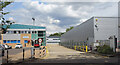
Business Park Buildings, Lysons Avenue
Image: © Des Blenkinsopp
Taken: 4 Aug 2022
0.09 miles
8
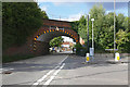
Ash Vale railway arch
The arch over Vale Road carrying the Aldershot to Woking line.
Image: © Alan Hunt
Taken: 2 Oct 2016
0.09 miles
9
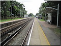
Ash Vale railway station, Surrey
Opened in 1870 by the London & South Western Railway on what is now the line from London Waterloo to Alton. This station was variously called "Aldershot North Camp & Ash Vale", "Aldershot Ash Vale for North Camp", "Aldershot for North Camp & South Farnborough" and "Ash Vale & South Farnborough"! The current name was settled on in 1955.
View south west towards Aldershot and Alton.
Image: © Nigel Thompson
Taken: 29 Jul 2011
0.10 miles
10
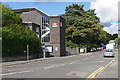
Ash Vale railway station
The entrance to Ash Vale station on Station Approach.
Image: © Alan Hunt
Taken: 2 Oct 2016
0.10 miles