IMAGES TAKEN NEAR TO
The Street, FARNHAM, GU10 4HX
Introduction
This page details the photographs taken nearby to The Street, GU10 4HX by members of the Geograph project.
The Geograph project started in 2005 with the aim of publishing, organising and preserving representative images for every square kilometre of Great Britain, Ireland and the Isle of Man.

There are currently over 7.5m images from over14,400 individuals and you can help contribute to the project by visiting https://www.geograph.org.uk
Image Map
Images are licensed for reuse under creativecommons.org/licenses/by-sa/2.0
Notes
- Clicking on the map will re-center to the selected point.
- The higher the marker number, the further away the image location is from the centre of the postcode.
Image Listing (18 Images Found)
Images are licensed for reuse under creativecommons.org/licenses/by-sa/2.0
Image
Details
Distance
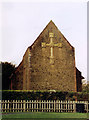
4
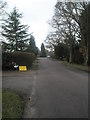
Church of the Good Shepherd, Dockenfield
Dockenfield is a ribbon like village with a main street which goes up and down a number of hills. No shops though.
Image: © Graham Clutton
Taken: 28 Dec 2005
0.05 miles
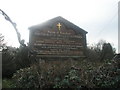
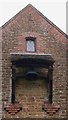
7
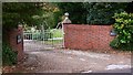
The Good Shepherd, Dockenfield
Built in 1910.
Image: © Michael FORD
Taken: Unknown
0.08 miles
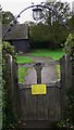
8
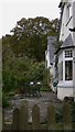
Looking down the church path at Dockenfield
Image: © Basher Eyre
Taken: 6 Feb 2010
0.08 miles
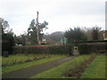
10
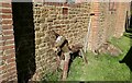
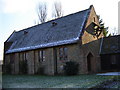
"Donkey" at the rear of Dockenfield Church
Image: © Basher Eyre
Taken: 25 Apr 2021
0.08 miles