
IMAGES TAKEN NEAR TO
Smiths Field, CIRENCESTER, GL7 1XX
Introduction
This page details the photographs taken nearby to Smiths Field, GL7 1XX by members of the Geograph project.
The Geograph project started in 2005 with the aim of publishing, organising and preserving representative images for every square kilometre of Great Britain, Ireland and the Isle of Man.

There are currently over 7.5m images from over14,400 individuals and you can help contribute to the project by visiting https://www.geograph.org.uk
Image Map
Images are licensed for reuse under creativecommons.org/licenses/by-sa/2.0
Notes
- Clicking on the map will re-center to the selected point.
- The higher the marker number, the further away the image location is from the centre of the postcode.
Image Listing (27 Images Found)
Images are licensed for reuse under creativecommons.org/licenses/by-sa/2.0
Image
Details
Distance

3
Chesterton Lane
This road runs from the A419 Tetbury Rd which is behind the photographer, east across the south side of the centre of the town.
Image: © Nigel Mykura
Taken: 17 Jun 2012
0.04 miles
5
Bristol Road, Cirencester
Looking towards Chesterton Lane
Image: © David Howard
Taken: 23 May 2020
0.05 miles
6
The A419, Cirencester
At the end of Chesterton Lane
Image: © David Howard
Taken: 23 Mar 2019
0.05 miles

9
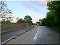
Old A419
This shows the quiet road with bicycle lane running along the wall belonging to Cirencester College. This used to be the A419 but this now passes further to the south where there is a large roundabout and this just leads to one of the college entrances.
Image: © Nigel Mykura
Taken: 7 Oct 2011
0.08 miles
10
![Cirencester features [13]](https://s3.geograph.org.uk/geophotos/06/84/65/6846563_74a84df3_120x120.jpg)
Cirencester features [13]
The entrance to Chesterton Cemetery from Chesterton Lane. The wall, railings and gates were erected in 1871 in ashlar with cast-iron and wrought-iron railings and gates. Listed, grade II, with details at: https://historicengland.org.uk/listing/the-list/list-entry/1205364
Cirencester, the largest town in the Cotswolds, is a market town some 15 miles south east of Gloucester and some 13 miles north west of Swindon. The town lies on the River Churn, a tributary of the River Thames and is the hub of a network of roads. It is the home of the Royal Agricultural University, founded in 1840. An important Roman settlement known as Corinium, the town, with 240 acres enclosed by walls was second only to London in size.
Image: © Michael Dibb
Taken: 12 May 2021
0.08 miles