
IMAGES TAKEN NEAR TO
Mount Street, CIRENCESTER, GL7 1TJ
Introduction
This page details the photographs taken nearby to Mount Street, GL7 1TJ by members of the Geograph project.
The Geograph project started in 2005 with the aim of publishing, organising and preserving representative images for every square kilometre of Great Britain, Ireland and the Isle of Man.

There are currently over 7.5m images from over14,400 individuals and you can help contribute to the project by visiting https://www.geograph.org.uk
Image Map
Images are licensed for reuse under creativecommons.org/licenses/by-sa/2.0
Notes
- Clicking on the map will re-center to the selected point.
- The higher the marker number, the further away the image location is from the centre of the postcode.
Image Listing (87 Images Found)
Images are licensed for reuse under creativecommons.org/licenses/by-sa/2.0
Image
Details
Distance
1
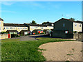
Martin Close, Cirencester
These properties are just south of a Roman amphitheatre. Cotswold Avenue runs out of sight between Martin Close and the viewpoint.
This is one of several images taken of or from the amphitheatre. Next image Image
Image: © Brian Robert Marshall
Taken: 23 Jun 2010
0.03 miles
2
![Cirencester houses [20]](https://s2.geograph.org.uk/geophotos/06/84/65/6846542_e7b6b552_120x120.jpg)
Cirencester houses [20]
Bland, modern and ugly housing in Cotswold Avenue.
Cirencester, the largest town in the Cotswolds, is a market town some 15 miles south east of Gloucester and some 13 miles north west of Swindon. The town lies on the River Churn, a tributary of the River Thames and is the hub of a network of roads. It is the home of the Royal Agricultural University, founded in 1840. An important Roman settlement known as Corinium, the town, with 240 acres enclosed by walls was second only to London in size.
Image: © Michael Dibb
Taken: 12 May 2021
0.03 miles
4
![Cirencester houses [19]](https://s3.geograph.org.uk/geophotos/06/84/65/6846535_086bc56d_120x120.jpg)
Cirencester houses [19]
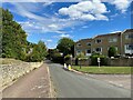
Just a glimpse of Hillside Cottage, number 16 Somerford Road. Built in the 18th century with early 20th century alterations. Constructed of coursed rubble stone under a Welsh slate roof. Listed, grade II, with details at: https://historicengland.org.uk/listing/the-list/list-entry/1298659
Cirencester, the largest town in the Cotswolds, is a market town some 15 miles south east of Gloucester and some 13 miles north west of Swindon. The town lies on the River Churn, a tributary of the River Thames and is the hub of a network of roads. It is the home of the Royal Agricultural University, founded in 1840. An important Roman settlement known as Corinium, the town, with 240 acres enclosed by walls was second only to London in size.
Image: © Michael Dibb
Taken: 12 May 2021
0.04 miles
5
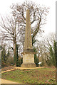
Cirencester Obelisk
Enigmatic obelisk by the site of the Roman Amphitheatre, thought to be an 18th century folly in Cirencester Park.
Image: © Richard Croft
Taken: 18 Jan 2017
0.05 miles
7
![Cirencester features [12]](https://s2.geograph.org.uk/geophotos/06/84/65/6846538_1fc3a3d7_120x120.jpg)
Cirencester features [12]
An information board seen alongside the obelisk seen at Image
Cirencester, the largest town in the Cotswolds, is a market town some 15 miles south east of Gloucester and some 13 miles north west of Swindon. The town lies on the River Churn, a tributary of the River Thames and is the hub of a network of roads. It is the home of the Royal Agricultural University, founded in 1840. An important Roman settlement known as Corinium, the town, with 240 acres enclosed by walls was second only to London in size.
Image: © Michael Dibb
Taken: 12 May 2021
0.05 miles
8
![Cirencester features [11]](https://s0.geograph.org.uk/geophotos/06/84/65/6846536_c398519c_120x120.jpg)
Cirencester features [11]
Little is recorded about this obelisk just off Cotswold Avenue. Constructed in the 18th century of limestone ashlar. Probably erected for Earl Bathurst as this point was once his land and it may mark the boundary of the estate. Listed, grade II*, with details at: https://historicengland.org.uk/listing/the-list/list-entry/1187413
Cirencester, the largest town in the Cotswolds, is a market town some 15 miles south east of Gloucester and some 13 miles north west of Swindon. The town lies on the River Churn, a tributary of the River Thames and is the hub of a network of roads. It is the home of the Royal Agricultural University, founded in 1840. An important Roman settlement known as Corinium, the town, with 240 acres enclosed by walls was second only to London in size.
Image: © Michael Dibb
Taken: 12 May 2021
0.05 miles
9
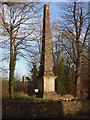
The Cirencester Obelisk
The tower of the church of St John the Baptist in the distance.
Image: © Chris Andrews
Taken: 25 Feb 2020
0.05 miles
10
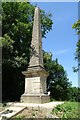
The Cirencester Obelisk
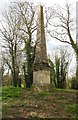
The Cirencester Obelisk is thought to date from the 18th century. The stonework suggests it dates from the 1740s though it does not appear on a map until 1807. When erected this was land belonging to the Bathursts of Cirencester Park. The obelisk is Grade II* listed.
Image: © Philip Halling
Taken: 3 Jul 2018
0.05 miles