
IMAGES TAKEN NEAR TO
Ashcroft Road, CIRENCESTER, GL7 1QZ
Introduction
This page details the photographs taken nearby to Ashcroft Road, GL7 1QZ by members of the Geograph project.
The Geograph project started in 2005 with the aim of publishing, organising and preserving representative images for every square kilometre of Great Britain, Ireland and the Isle of Man.

There are currently over 7.5m images from over14,400 individuals and you can help contribute to the project by visiting https://www.geograph.org.uk
Image Map
Images are licensed for reuse under creativecommons.org/licenses/by-sa/2.0
Notes
- Clicking on the map will re-center to the selected point.
- The higher the marker number, the further away the image location is from the centre of the postcode.
Image Listing (852 Images Found)
Images are licensed for reuse under creativecommons.org/licenses/by-sa/2.0
Image
Details
Distance
1
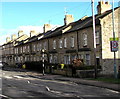
Ashcroft Road houses, Cirencester
Houses on the south side of the road, viewed from near the Sheep Street mini-roundabout.
Image: © Jaggery
Taken: 10 Feb 2016
0.01 miles
2
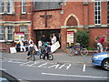
Ashcroft Methodist Church Cirencester
In Ashcroft Road Cirencester
Image: © Peter Watkins
Taken: 10 Sep 2005
0.02 miles
3
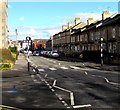
Zebra crossing, Ashcroft Road, Cirencester
Viewed from near the Sidings Veterinary Surgery on the corner of Sheep Street.
Image: © Jaggery
Taken: 10 Feb 2016
0.03 miles
4
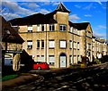
Late 20th century building, Ashcroft Road, Cirencester
The year 1991 is inscribed on the three-storey building on the corner opposite the Sidings Veterinary Surgery.
Image: © Jaggery
Taken: 10 Feb 2016
0.04 miles
5
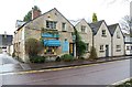
The Letter Press, 3 Cripps Road, Cirencester, Glos
The Letter Press was set up in 1986 and uses traditional letterpress and litho printing machinery to print wedding, personal and social stationery. It also offers dye stamping and there is a gift shop here.
Image: © P L Chadwick
Taken: 22 Dec 2013
0.04 miles
6
Cirencester exit
Mellow stone buildings overlook this busy road intersection, on the western side of the town.
Image: © Roger Cornfoot
Taken: 16 Jan 2007
0.04 miles
7
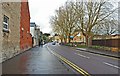
Cripps Road, Cirencester, Glos
There are various businesses along here and the road also goes to the back of a Tesco supermarket. It also gives access to the Brewery Car Park, a short-stay town centre car park.
Image: © P L Chadwick
Taken: 22 Dec 2013
0.05 miles
8
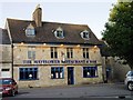
Former Railway Inn Cirencester
Former Railway Inn Sheep Street Cirencester
Historical information links
http://pubshistory.com/Gloucestershire/Cirencester/index.shtml
http://www.gloucestershirepubs.co.uk/FeatureFiller/index.php
Image: © Paul Best
Taken: 21 Jun 2013
0.05 miles
9
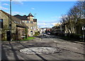
Sheep Street mini-roundabout, Cirencester
At the Ashcroft Road (ahead) junction.
Image: © Jaggery
Taken: 10 Feb 2016
0.06 miles
10
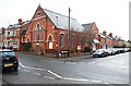
Cirencester Ashcroft Church, 21 Ashcroft Road, Cirencester, Glos
This large church is on the corner of Ashcroft Road and Ashcroft Gardens. It was built as a Methodist church in 1896. Today it is a joint Methodist and United Reformed church. The Ashcroft Centre is based here. This opened in 1995 and provides a modern suite of different sized rooms on two floors to meet the needs of the church and the wider community.
Image: © P L Chadwick
Taken: 22 Dec 2013
0.07 miles