
IMAGES TAKEN NEAR TO
Price Place, CIRENCESTER, GL7 1QF
Introduction
This page details the photographs taken nearby to Price Place, GL7 1QF by members of the Geograph project.
The Geograph project started in 2005 with the aim of publishing, organising and preserving representative images for every square kilometre of Great Britain, Ireland and the Isle of Man.

There are currently over 7.5m images from over14,400 individuals and you can help contribute to the project by visiting https://www.geograph.org.uk
Image Map
Images are licensed for reuse under creativecommons.org/licenses/by-sa/2.0
Notes
- Clicking on the map will re-center to the selected point.
- The higher the marker number, the further away the image location is from the centre of the postcode.
Image Listing (17 Images Found)
Images are licensed for reuse under creativecommons.org/licenses/by-sa/2.0
Image
Details
Distance
1
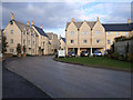
Kingshill Meadow, Cirencester
An estate of new houses on the outskirts of Cirencester.
Image: © Vieve Forward
Taken: 8 Nov 2012
0.14 miles
2
Roundabout on Bristol Road, Cirencester
Image: © David Howard
Taken: 23 Mar 2019
0.15 miles
3
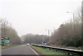
Looking back on the A419 towards Cirencester
The old town was once the Roman town of Corinium and is now often known as the capital of the Cotswolds.
Image: © James Denham
Taken: 12 Jan 2012
0.16 miles
4
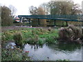
Footbridge over the River Churn near Tesco superstore, Cirencester
This new footbridge provides access to the superstore for those living the other side of the dual carriageway. The picture was taken after mild flooding.
Image: © Vieve Forward
Taken: 8 Nov 2012
0.17 miles
6
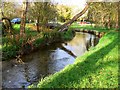
River Churn, Cirencester
The Churn rises near Cheltenham and joins the Thames near Cricklade, passing through Cirencester where this picture was taken.
Image: © Brian Robert Marshall
Taken: 10 Nov 2007
0.18 miles
7
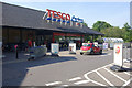
Tesco, Cirencester
Tesco's large out-of-town Cirencester store.
Image: © Stephen McKay
Taken: 6 Jul 2013
0.18 miles
8
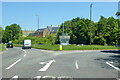
Roundabout exit on A429, Cirencester
Further round for the A419 southwards.
Image: © Robin Webster
Taken: 30 May 2021
0.19 miles
9
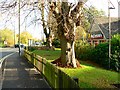
Cricklade Road and McDonald's, Cirencester
The cars in the image are either going to or leaving the Tesco superstore out of sight at the end of the road the cars are on. At the right is the Cirencester branch of McDonald's fast food restaurants. There are some fine trees in their grounds.
Image: © Brian Robert Marshall
Taken: 10 Nov 2007
0.21 miles
10
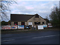
Greasy Joe's Cafe, The Lorry Park, Cricklade Road
The current proprietor has been serving customers at Greasy Joe's for 34 years. The diner is well situated to cater for truck drivers stopping at the lorry park behind, as well as any other customers. It used to be open 24/7, but is now, alas, closed overnight and on Sundays.
Image: © Vieve Forward
Taken: 8 Nov 2012
0.21 miles