
IMAGES TAKEN NEAR TO
The Woodbine, CIRENCESTER, GL7 1JE
Introduction
This page details the photographs taken nearby to The Woodbine, GL7 1JE by members of the Geograph project.
The Geograph project started in 2005 with the aim of publishing, organising and preserving representative images for every square kilometre of Great Britain, Ireland and the Isle of Man.

There are currently over 7.5m images from over14,400 individuals and you can help contribute to the project by visiting https://www.geograph.org.uk
Image Map
Images are licensed for reuse under creativecommons.org/licenses/by-sa/2.0
Notes
- Clicking on the map will re-center to the selected point.
- The higher the marker number, the further away the image location is from the centre of the postcode.
Image Listing (33 Images Found)
Images are licensed for reuse under creativecommons.org/licenses/by-sa/2.0
Image
Details
Distance
1
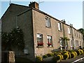
Former Star Inn Cirencester
Former Star Inn Chesterton Lane Cirencester
Historical information links
http://pubshistory.com/Gloucestershire/Cirencester/index.shtml
http://www.gloucestershirepubs.co.uk/FeatureFiller/index.php
Image: © Paul Best
Taken: 21 Jun 2013
0.02 miles
2
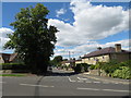
Somerford Road, Cirencester
Somerford Road is a residential road in Cirencester, in Gloucestershire.
Image: © Malc McDonald
Taken: 11 Jul 2020
0.06 miles
3
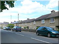
Chesterton Lane
These relatively modern terraced houses on the southern outskirts of Cirencester are faced with local stone.
Image: © Nigel Mykura
Taken: 17 Jun 2012
0.07 miles
4

New houses on Somerford Road, Cirencester
Image: © David Howard
Taken: 23 Mar 2019
0.11 miles
5
Houses by Chesterton Road, Cirencester
Image: © David Howard
Taken: 23 Mar 2019
0.13 miles
6
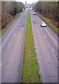
Cirencester ring road
A shot of the ring road looking South East
Image: © Roger May
Taken: 29 Feb 2012
0.14 miles
7

South-east along old Great Western Railway railway trackbed, Cirencester
From 1841 until 1964 there was a small branch line from Kemble Station (still open) Image to a terminus at Cirencester, behind the viewpoint. Nowadays the trackbed serves as a shortcut from relatively modern housing in Meadow Close in the direction of view to Sheep Street and an easy walk into the town over the Bristol Road dual carriageway.
Image: © Brian Robert Marshall
Taken: 28 Jun 2014
0.15 miles
8
![Cirencester features [10]](https://s2.geograph.org.uk/geophotos/06/84/56/6845614_6cf673aa_120x120.jpg)
Cirencester features [10]
Bristol Road, A429, is a dual carriageway part of the Cirencester by-pass. Seen here, looking south, from the bridge carrying Somerford Road.
Cirencester, the largest town in the Cotswolds, is a market town some 15 miles south east of Gloucester and some 13 miles north west of Swindon. The town lies on the River Churn, a tributary of the River Thames and is the hub of a network of roads. It is the home of the Royal Agricultural University, founded in 1840. An important Roman settlement known as Corinium, the town, with 240 acres enclosed by walls was second only to London in size.
Image: © Michael Dibb
Taken: 12 May 2021
0.16 miles
9

North-west along old Great Western Railway railway trackbed, Cirencester
From 1841 until 1964 there was a small branch line from Kemble Station (still open) Image to a terminus at Cirencester, in the direction of view. Nowadays the trackbed serves as a shortcut from relatively modern housing in Meadow Close behind the viewpoint to Sheep Street and an easy walk into the town over the Bristol Road dual carriageway.
Image: © Brian Robert Marshall
Taken: 28 Jun 2014
0.18 miles
10
![Cirencester houses [19]](https://s3.geograph.org.uk/geophotos/06/84/65/6846535_086bc56d_120x120.jpg)
Cirencester houses [19]
Just a glimpse of Hillside Cottage, number 16 Somerford Road. Built in the 18th century with early 20th century alterations. Constructed of coursed rubble stone under a Welsh slate roof. Listed, grade II, with details at: https://historicengland.org.uk/listing/the-list/list-entry/1298659
Cirencester, the largest town in the Cotswolds, is a market town some 15 miles south east of Gloucester and some 13 miles north west of Swindon. The town lies on the River Churn, a tributary of the River Thames and is the hub of a network of roads. It is the home of the Royal Agricultural University, founded in 1840. An important Roman settlement known as Corinium, the town, with 240 acres enclosed by walls was second only to London in size.
Image: © Michael Dibb
Taken: 12 May 2021
0.18 miles