
IMAGES TAKEN NEAR TO
Brownshill, STROUD, GL6 8AW
Introduction
This page details the photographs taken nearby to GL6 8AW by members of the Geograph project.
The Geograph project started in 2005 with the aim of publishing, organising and preserving representative images for every square kilometre of Great Britain, Ireland and the Isle of Man.

There are currently over 7.5m images from over14,400 individuals and you can help contribute to the project by visiting https://www.geograph.org.uk
Image Map
Images are licensed for reuse under creativecommons.org/licenses/by-sa/2.0
Notes
- Clicking on the map will re-center to the selected point.
- The higher the marker number, the further away the image location is from the centre of the postcode.
Image Listing (7 Images Found)
Images are licensed for reuse under creativecommons.org/licenses/by-sa/2.0
Image
Details
Distance
1
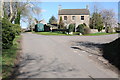
Brownhills Road
House of Brownhills Road.
Image: © Philip Halling
Taken: 10 Mar 2012
0.07 miles
2
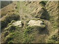
Possible slab stone, Blackness-to-Brownshill GS9285
Large stones (possible lost stile) in the ground in large field between the farm in Brownshill and Blackness, just below a wooden stile into the farmyard at the top. On public right of way MCH32
Image: © Cotswold Voluntary Wardens
Taken: 2 Mar 2013
0.16 miles
3
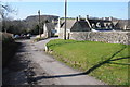
Monastery of Our Lady and St Bernard
The Monastery of Our Lady and St Bernard is situated at Brownhills, above the Stroud valley.
Image: © Philip Halling
Taken: 10 Mar 2012
0.17 miles
4
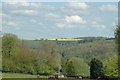
Taken near Brownshill looking SE across the Golden Valley
Brownshill, Bussage and Eastcombe sit on the Cotswold Hills above the Golden and Toadsmoor valleys. The villages sit on the side of the valleys while horses and fields of rape populate the tops of the hills.
Image: © Andy Phillips
Taken: 3 May 2005
0.19 miles
5
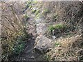
Possible slab stone, Blackness to Brownshill2 GS9286
Large stones (possible lost stile) in the ground in large field between the farm in Brownshill and Blackness, just below a wooden stile into the farmyard at the top. On public right of way MCH33
Image: © Cotswold Voluntary Wardens
Taken: 2 Mar 2013
0.21 miles
6
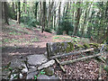
Stone Stile, Toadsmoor Woods
Near Brownshill House & "Our Lady of Victory" RC Retreat. On Gloucestershire footpath MCH27 looking South, the view looking North is Image
Image: © Ian Kenny Roberts
Taken: 25 Apr 2022
0.22 miles
7
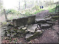
Stone Stile, Toadsmoor Woods
Near Brownshill House & "Our Lady of Victory" RC Retreat. On Gloucestershire footpath MCH27 looking North, the view looking South is Image
Image: © Ian Kenny Roberts
Taken: 25 Apr 2022
0.22 miles