IMAGES TAKEN NEAR TO
Jacks Green, STROUD, GL6 7RD
Introduction
This page details the photographs taken nearby to Jacks Green, GL6 7RD by members of the Geograph project.
The Geograph project started in 2005 with the aim of publishing, organising and preserving representative images for every square kilometre of Great Britain, Ireland and the Isle of Man.

There are currently over 7.5m images from over14,400 individuals and you can help contribute to the project by visiting https://www.geograph.org.uk
Image Map
Images are licensed for reuse under creativecommons.org/licenses/by-sa/2.0
Notes
- Clicking on the map will re-center to the selected point.
- The higher the marker number, the further away the image location is from the centre of the postcode.
Image Listing (18 Images Found)
Images are licensed for reuse under creativecommons.org/licenses/by-sa/2.0
Image
Details
Distance
1
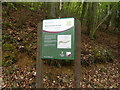
Blackstable Woods information board (east end)
Image: © Terry Jacombs
Taken: 18 May 2012
0.04 miles
3
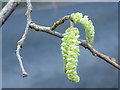
Hazel catkins, Corylus avellana
Detail from the hazel shown in context in Image
Image: © Jonathan Billinger
Taken: 11 Feb 2016
0.07 miles
4
Cockshoot Road in Blackstable Wood
Some Hazel (Corylus avellana) catkins are making their seasonal evidence here.
Image: © Jonathan Billinger
Taken: 11 Feb 2016
0.09 miles
5
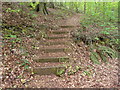
Wooden steps in Blackstable Woods
There are three tracks through Blackstable Woods here. These steps descend from the upper one to the middle one.
Image: © Terry Jacombs
Taken: 18 May 2012
0.09 miles
6
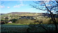
View over the Sheepscombe valley, 2
Looking north-west from the edge of Blackstabe Wood.
Image: © Jonathan Billinger
Taken: 11 Feb 2016
0.11 miles
7
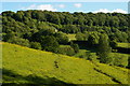
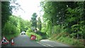
Sheepscombe valley, south side
Visible as a line across the distant woodland is the lane dropping down to the village from the B4070.
Image: © Christopher Hilton
Taken: 31 May 2011
0.11 miles
8
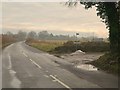
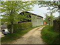
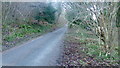
Track to Down Barn Farm
As it leaves the B4070. The track is shown as publicly accessible, and leads to a byway and a footpath.
Image: © Derek Harper
Taken: 2 Jan 2011
0.12 miles
9
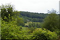
Sheepscombe valley, south side
Visible as a line across the distant woodland is the lane dropping down to the village from the B4070.
Image: © Christopher Hilton
Taken: 29 May 2011
0.12 miles