
IMAGES TAKEN NEAR TO
Lypiatt, STROUD, GL6 7LH
Introduction
This page details the photographs taken nearby to GL6 7LH by members of the Geograph project.
The Geograph project started in 2005 with the aim of publishing, organising and preserving representative images for every square kilometre of Great Britain, Ireland and the Isle of Man.

There are currently over 7.5m images from over14,400 individuals and you can help contribute to the project by visiting https://www.geograph.org.uk
Image Map
Images are licensed for reuse under creativecommons.org/licenses/by-sa/2.0
Notes
- Clicking on the map will re-center to the selected point.
- The higher the marker number, the further away the image location is from the centre of the postcode.
Image Listing (5 Images Found)
Images are licensed for reuse under creativecommons.org/licenses/by-sa/2.0
Image
Details
Distance
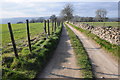
2
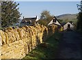
Stroud Slad Farm
An ambitious organic farm on the side of the Slad valley. The golden limestone wall beside Slad Lane looks a recent addition.
Image: © Derek Harper
Taken: 19 Oct 2007
0.22 miles
3
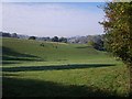
Field beside Slad Lane
Only the nearer part of this field, crossed by a combe in the side of the Slad valley, is in square. In the distance is All Saints church in Uplands, Stroud.
Image: © Derek Harper
Taken: 19 Oct 2007
0.23 miles
4
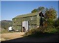
Barn at Stroud Slad Farm
Quite an impressive corrugated iron structure, seen from Slad Lane. The sign on the door directs one to the toilets, incidentally.
Image: © Derek Harper
Taken: 19 Oct 2007
0.24 miles
5
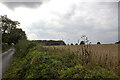
Wood and field
Wood and field off 40 Acres Lane
Image: © P Gaskell
Taken: Unknown
0.25 miles