
IMAGES TAKEN NEAR TO
The Vatch, STROUD, GL6 7JU
Introduction
This page details the photographs taken nearby to The Vatch, GL6 7JU by members of the Geograph project.
The Geograph project started in 2005 with the aim of publishing, organising and preserving representative images for every square kilometre of Great Britain, Ireland and the Isle of Man.

There are currently over 7.5m images from over14,400 individuals and you can help contribute to the project by visiting https://www.geograph.org.uk
Image Map
Images are licensed for reuse under creativecommons.org/licenses/by-sa/2.0
Notes
- Clicking on the map will re-center to the selected point.
- The higher the marker number, the further away the image location is from the centre of the postcode.
Image Listing (16 Images Found)
Images are licensed for reuse under creativecommons.org/licenses/by-sa/2.0
Image
Details
Distance
1
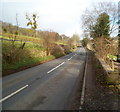
The B4070 between Stroud and Slad
Looking NE along the B4070 in the direction of the Cotswolds village of Slad.
The perimeter wall of The Reddings is on the right. Hazeling is on the left.
Image: © Jaggery
Taken: 8 Jan 2012
0.05 miles
2

B4070 Slad Road
Towards Slad from Stroud.
Image: © Robin Webster
Taken: 9 Jan 2022
0.09 miles
3
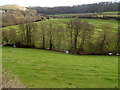
Slad Brook viewed from the B4070
Looking down Slad Valley towards Slad Brook.
Image: © Jaggery
Taken: 8 Jan 2012
0.11 miles
4
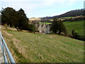
Hazel Mill, Vatch, Stroud
Viewed from railings alongside Slad Road. The house is at the edge of Slad Brook.
Image: © Jaggery
Taken: 8 Jan 2012
0.12 miles
5
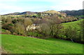
Spring Cottages, The Vatch near Slad
A view NE from the B4070 down Slad Valley looking beyond trees towards Spring Cottages, alongside Slad Brook.
Image: © Jaggery
Taken: 8 Jan 2012
0.13 miles
6

NE boundary of Stroud
The B4070 reaches Stroud. The town's name sign shows that Stroud is the world's first Bee Guardian town. http://www.geograph.org.uk/photo/2756217
Image: © Jaggery
Taken: 8 Jan 2012
0.14 miles
7

Stroud - the world's first Bee Guardian town
In the summer of 2011, new Stroud boundary signs were installed. They show that the town is the world's first Bee Guardian town. The Bee Guardian Foundation is an educational conservation organisation that aims to help all bee species and other pollinators, empowering people, institutions, companies, towns and cities to become Bee Guardians.
Stroud's commitment means that the town aims to
● Protect and enhance bee diversity in the town.
● Raise awareness and educate the community about the importance of bee diversity, including bumble bees, solitary bees and other pollinators.
● Improve the health, mentally and physically, of Stroud's people by encouraging them to participate in the Stroud Bee Guardian town, so that they will visit, enjoy and appreciate the green spaces and footpaths managed by Stroud Town Council.
● Lead the way in protecting bee diversity within the town.
Examples of the new commitment are:
● The Stroud Green Spaces team has pledged not to use pesticides in the town’s 24 Green Spaces and to use bee-friendly pollination plants.
● The town council has changed how it manages dead trees by leaving stumps which volunteers then drill to provide bee houses.
Image: © Jaggery
Taken: 8 Jan 2012
0.14 miles
8
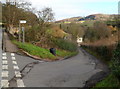
Road to The Vatch and Elcombe, south of Slad
Slad Lane descends from the B4070 south of Slad, towards Slad Brook which flows through Slad Valley. Communities ahead signposted at the junction are The Vatch and Elcombe.
Image: © Jaggery
Taken: 8 Jan 2012
0.17 miles
9
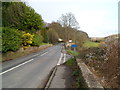
Right turn ahead (south of Slad) unsuitable for HGVs
The right turn from the B4070 is into Slad Lane http://www.geograph.org.uk/photo/2756290 descending Slad Valley towards Slad Brook and the communities of The Vatch and Elcombe.
Image: © Jaggery
Taken: 8 Jan 2012
0.17 miles
10
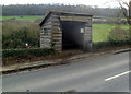
Wooden bus shelter south of Slad
The wooden shelter is alongside the B4070 about 40 metres NNE of the Slad Lane junction. http://www.geograph.org.uk/photo/2756290
Image: © Jaggery
Taken: 8 Jan 2012
0.17 miles