
IMAGES TAKEN NEAR TO
Painswick Beacon, Painswick, STROUD, GL6 6SX
Introduction
This page details the photographs taken nearby to GL6 6SX by members of the Geograph project.
The Geograph project started in 2005 with the aim of publishing, organising and preserving representative images for every square kilometre of Great Britain, Ireland and the Isle of Man.

There are currently over 7.5m images from over14,400 individuals and you can help contribute to the project by visiting https://www.geograph.org.uk
Image Map
Images are licensed for reuse under creativecommons.org/licenses/by-sa/2.0
Notes
- Clicking on the map will re-center to the selected point.
- The higher the marker number, the further away the image location is from the centre of the postcode.
Image Listing (20 Images Found)
Images are licensed for reuse under creativecommons.org/licenses/by-sa/2.0
Image
Details
Distance
1

Old barns at Spoonbed Farm
A sign warns 'Dangerous building Keep Clear - do not enter'.
Image: © Jeremy Bolwell
Taken: 6 Oct 2012
0.01 miles
2

Spoonbed farmhouse
Not a bad little Cotswold farmhouse.
Image: © Jeremy Bolwell
Taken: 6 Oct 2012
0.02 miles
3
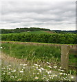
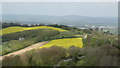
From Cud Hill grid over Spoonbed - Upton St Leonards, Gloucestershire
Taken from the same viewpoint as 'Cud Hill near close of day' but facing south east instead of west. The lane over Cud Hill which links the B4073 Gloucester - Painswick road to the south of Upton St Leonards with the A4173 Gloucester - Stroud road at Edge. Common land at Cud Hill of just over 8 acres is the site of grazing by cattle of local farmers to keep grass down and give species of flora a chance to flourish under a scheme run jointly by the Cotswolds Conservation Board and Natural England. To the right, on the right of this lane is a memorial to architect Detmar Blow and Winifred his wife, who lived at Hilles House which looks out over Brookthorpe towards Robinswood Hill, which is now a country park run by Gloucester City Council. To the south east the Cotswold Way passes over Painswick Hill on its route from Chipping Campden (silent p) to Bath, making a very pleasant week or more of walking. Time taken 5.40 pm BST (British Summer Time).
Image Image
Image: © Martin Richard Phelan
Taken: 23 Jun 2013
0.04 miles
4

Paddock at the top of the Wash Brook valley near Painswick
Two ponies turn to inspect my passing and a bright 'cloud' of morning fog lies lower down in the valley.
Image: © Jeremy Bolwell
Taken: 6 Oct 2012
0.06 miles
6
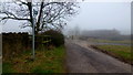
Footpath to Spoonbed Farm
Spoonbed Hill is obscured by the winter hill fog.
Image: © Jonathan Billinger
Taken: 30 Jan 2014
0.11 miles
7
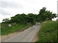
To stop them wandering - Painswick, Gloucestershire
On this stretch of unfenced road, running beside Spoonbed Hill and Cud Hill to the north of Painswick, an example of one method of controlling the movements of livestock, for their own safety and that of road users. Time taken 5.44 pm BST (British Summer Time).
Image Image
Image: © Martin Richard Phelan
Taken: 23 Jun 2013
0.11 miles
8

Field on Spoonbed Hill
From beneath the shade of a tree, a view across a field towards the Holcombe valley.
Image: © Derek Harper
Taken: 4 Jul 2008
0.13 miles
9
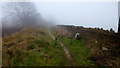
The Wysis Way, east
A cold misty day on the edge of the Cotswolds below Spoonbed Hill.
Image: © Jonathan Billinger
Taken: 30 Jan 2014
0.13 miles
10

An unusual structure
This arched entrance way leads to a field and nothing more. I am intrigued as to its purpose. It looks like it should herald the entrance to an estate, but it doesn't. Below the wall adjacent to the road was a pile of Cotswold Stone (an oolitic limestone) and a sign saying 'knock down stones'. No idea what that was for either - a mystery!
Image: © Sharon Loxton
Taken: 8 Jul 2008
0.13 miles