IMAGES TAKEN NEAR TO
Paul Mead, STROUD, GL6 6PG

Introduction

This page details the photographs taken nearby to Paul Mead, GL6 6PG by members of the Geograph project.

The Geograph project started in 2005 with the aim of publishing, organising and preserving representative images for every square kilometre of Great Britain, Ireland and the Isle of Man.

There are currently over 7.5m images from over14,400 individuals and you can help contribute to the project by visiting https://www.geograph.org.uk

Image Map


Images are licensed for reuse under creativecommons.org/licenses/by-sa/2.0
Notes
  • Clicking on the map will re-center to the selected point.
  • The higher the marker number, the further away the image location is from the centre of the postcode.

Image Listing (28 Images Found)

Images are licensed for reuse under creativecommons.org/licenses/by-sa/2.0
  • ...
Image
Details
Distance
1
Edge church
Image: © Philip Halling Taken: 5 Jan 2013
0.04 miles
2
Road through Edge
Country road through the small village of Edge, an appropriate name as the Cotswold escarpment falls away to the left.
Image: © Philip Halling Taken: 5 Jan 2013
0.08 miles
3
The Edge (Glos) St John the Baptist's Church
Image: © ChurchCrawler Taken: 31 May 2003
0.10 miles
4
Snow on the road at Edge
Edge is halfway between Gloucester and Stroud and had few houses until the 1950's when an army camp was developed into a housing estate.
Image: © Jack Hill Taken: Unknown
0.10 miles
5
Edge, literally
The edge of the Cotswold scarp above the village of Edge.
Image: © Jonathan Billinger Taken: 7 Feb 2014
0.11 miles
6
Letterbox at Edge
A George V postbox in a wall at Edge.
Image: © Philip Halling Taken: 5 Jan 2013
0.11 miles
7
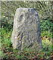
Old Boundary Marker by Grunters Lane, Harescombe parish
Parish Boundary Marker - Turnpike by the UC road, in parish of Harescombe (Stroud District), Grunters Lane, Edge, opposite minor cut-through, next to wooden power pole. Surveyed Milestone Society National ID: GL_HARPAI02pb
Image: © Mr Red Taken: Unknown
0.12 miles
8
Old Boundary Post, Edge
Cast iron boundary marker, defining a pre 1936 boundary between Brookthorpe and Painswick parish administrations. It still marks the modern Harescombe/Painswick boundary. It lies less than 10yds from an older boundary stone Image The top triangular flat probably defines the "Gloucester Hundred Division" responsible for roads and such in olden times. Inscription: G (?) / D // Brookthorpe // Painswick Grade II Listed see https://historicengland.org.uk/listing/the-list/list-entry/1154337 Milestone Society National ID: GL_GLSD05pb
Image: © Mr Red Taken: 20 Mar 2022
0.12 miles
9
Direction Sign ? Signpost
Located on the west side of the crossroads southwest of Edge in Harescombe parish. 3 arms and no finial. See also https://www.geograph.org.uk/photo/3297084. Milestone Society National ID: GL_SO8409
Image: © Mr Red Taken: 9 Feb 2019
0.12 miles
10
Road junction at Edge
Road junction at Edge, with the spire of Edge church in the background.
Image: © Philip Halling Taken: 5 Jan 2013
0.12 miles
  • ...