
IMAGES TAKEN NEAR TO
Callowell, STROUD, GL6 6EA
Introduction
This page details the photographs taken nearby to Callowell, GL6 6EA by members of the Geograph project.
The Geograph project started in 2005 with the aim of publishing, organising and preserving representative images for every square kilometre of Great Britain, Ireland and the Isle of Man.

There are currently over 7.5m images from over14,400 individuals and you can help contribute to the project by visiting https://www.geograph.org.uk
Image Map
Images are licensed for reuse under creativecommons.org/licenses/by-sa/2.0
Notes
- Clicking on the map will re-center to the selected point.
- The higher the marker number, the further away the image location is from the centre of the postcode.
Image Listing (10 Images Found)
Images are licensed for reuse under creativecommons.org/licenses/by-sa/2.0
Image
Details
Distance
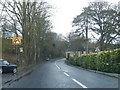
2
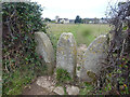
Twin Stone Stile, Whiteshill
His & Her's style. The track leads from Stokenhill where there is another similar style stile Image & Image (N of here). View looking NW, the view from looking SE is Image
Image: © Mr Red
Taken: 5 Dec 2021
0.16 miles
3
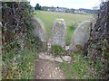
Twin Stone Stile, Whiteshill
His & Her's style. The track leads from Stokenhill where there is another similar style stile Image & Image (N of here). View looking NW, the view from looking SE is Image
Image: © Mr Red
Taken: 5 Dec 2021
0.16 miles
4
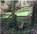
Stile to a public footpath to Callowell
On the west side of Painswick Road, opposite The Old Malthouse. http://www.geograph.org.uk/photo/3986718
Image: © Jaggery
Taken: 23 Mar 2014
0.16 miles
5
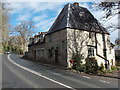
The Old Malthouse, Stroud
Viewed across the A46 Painswick Road.
Image: © Jaggery
Taken: 23 Mar 2014
0.17 miles
6
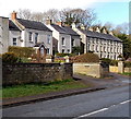
Windsor Villas and Windsor Place, Stroud
Viewed across the A46 Painswick Road. Windsor Place is on the right.
Image: © Jaggery
Taken: 23 Mar 2014
0.20 miles
7
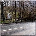
Northern boundary sign, Stroud
The sign alongside the A46 Painswick Road shows that Stroud is twinned with Saint Ismier (France).
Image: © Jaggery
Taken: 23 Mar 2014
0.21 miles
8
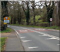
Welcome to Stroud
The 50mph speed limit along the A46 Painswick Road drops to 40 at the Welcome sign.
Image: © Jaggery
Taken: 23 Mar 2014
0.22 miles
9
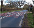
40 to 50 north of Stroud
The speed limit along the A46 Painswick Road increases from 40mph to 50mph.
The circular 50 sign on the right is on the back of a Welcome to Stroud sign. http://www.geograph.org.uk/photo/3986802
Image: © Jaggery
Taken: 23 Mar 2014
0.22 miles
10
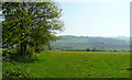
View east from Whiteshill
Stokenhill Farm and Rockfield House are visible on the valley side in the distance.
Image: © Jonathan Billinger
Taken: 6 May 2008
0.23 miles