IMAGES TAKEN NEAR TO
Downend, STROUD, GL6 0PQ
Introduction
This page details the photographs taken nearby to Downend, GL6 0PQ by members of the Geograph project.
The Geograph project started in 2005 with the aim of publishing, organising and preserving representative images for every square kilometre of Great Britain, Ireland and the Isle of Man.

There are currently over 7.5m images from over14,400 individuals and you can help contribute to the project by visiting https://www.geograph.org.uk
Image Map
Images are licensed for reuse under creativecommons.org/licenses/by-sa/2.0
Notes
- Clicking on the map will re-center to the selected point.
- The higher the marker number, the further away the image location is from the centre of the postcode.
Image Listing (20 Images Found)
Images are licensed for reuse under creativecommons.org/licenses/by-sa/2.0
Image
Details
Distance
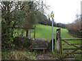
1
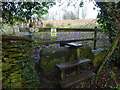
Stone Stile, Horsley
At the junction of Gloucestershire footpaths MHO19 & MHO18, looking into the field. The view looking SW along MHO18 is Image
Image: © Mr Red
Taken: 11 Jan 2022
0.07 miles
2
Stone Stile, Horsley
At the junction of Gloucestershire footpaths MHO19 & MHO18, looking SW along MHO18. The view looking NE into the field is Image
Image: © Mr Red
Taken: 11 Jan 2022
0.07 miles
3
Stone Stile, Horsley
Looking South from the top field (rented by Ben) on Gloucestershire footpaths MHO18 & MHO17. The view looking North is Image
Image: © Mr Red
Taken: 11 Jan 2022
0.12 miles
4
Stone Stile, Horsley
Looking North into the top (rented by Ben) field on Gloucestershire footpaths MHO18 & MHO17. The view looking South is Image
Image: © Mr Red
Taken: 11 Jan 2022
0.12 miles
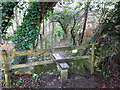
5
Stone Stile, Horsley
Off Narrowcut Lane, on Gloucestershire footpath MHO75 looking West. The view looking East is Image
Image: © Mr Red
Taken: 11 Jan 2022
0.13 miles
6
Stone Stile, Horsley
Off Narrowcut Lane, on Gloucestershire footpath MHO75 looking East. The view looking West is Image
Image: © Mr Red
Taken: 11 Jan 2022
0.13 miles
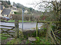
7
Old Milestone, Horsley
About ⅕ mile from the village wayside cross (and war memorial) on the Western side of Horsley Hill. Triangular with evidence of a plate in the RH face and features that supported chevron plate similar to: Image
Inscription (was): Nailsworth 1 // Wotton under Edge 7
Milestone Society ID: GL_WENW07
Image: © Mr Red
Taken: 22 Nov 2022
0.15 miles
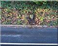
8
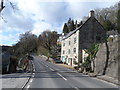
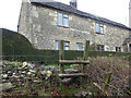
Building at the foot of Horsley Hill
It looks like and old mill.
Image: © Bikeboy
Taken: 8 Apr 2014
0.16 miles
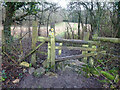
9
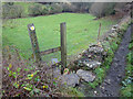
Stone Stile, Horsley
A "gap in the wall" stile under the wooden structure. Looking NE on Gloucestershire footpath MHO62 to MHO70. The view looking into the field is Image
Image: © Mr Red
Taken: 11 Jan 2022
0.16 miles
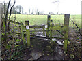
10
Stone Stile, Horsley
A "gap in the wall" stile under the wooden structure. Looking SW to Gloucestershire footpath MHO62 from MHO70. The view looking from the field is Image
Image: © Mr Red
Taken: 11 Jan 2022
0.16 miles