
IMAGES TAKEN NEAR TO
Orchard Road, STROUD, GL5 4UA
Introduction
This page details the photographs taken nearby to Orchard Road, GL5 4UA by members of the Geograph project.
The Geograph project started in 2005 with the aim of publishing, organising and preserving representative images for every square kilometre of Great Britain, Ireland and the Isle of Man.

There are currently over 7.5m images from over14,400 individuals and you can help contribute to the project by visiting https://www.geograph.org.uk
Image Map
Images are licensed for reuse under creativecommons.org/licenses/by-sa/2.0
Notes
- Clicking on the map will re-center to the selected point.
- The higher the marker number, the further away the image location is from the centre of the postcode.
Image Listing (84 Images Found)
Images are licensed for reuse under creativecommons.org/licenses/by-sa/2.0
Image
Details
Distance
1
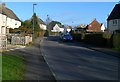
Southern arm of Orchard Road, Ebley
Viewed from the Ebley Road end. Ahead, the course of Orchard Road is a large loop on the southern side of a railway line.
Image: © Jaggery
Taken: 15 Jan 2012
0.07 miles
2
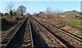
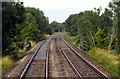
Railway lines west of Ebley level crossing
Viewed from the middle of the level crossing. http://www.geograph.org.uk/photo/2768825
The lines head towards Stonehouse station, about 2km away.
Stroud station is about 3km behind the camera.
Image: © Jaggery
Taken: 15 Jan 2012
0.08 miles
3
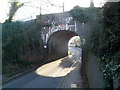
Foxmoor Lane railway bridge, Ebley
The bridge carries a double track railway line over Foxmoor Lane, between Stonehouse station and Stroud station. The identification notice on the bridge is
Ebley Road 103m 61.5ch SWM. A warning triangle on the bridge shows a headroom of 10 feet.
Image: © Jaggery
Taken: 15 Jan 2012
0.08 miles
4
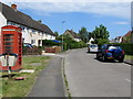
Orchard Road, Ebley, Stroud
Orchard Road is at the western edge of Ebley, near the Stonehouse boundary.
Image: © Jaggery
Taken: 7 May 2017
0.09 miles
6
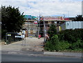
Construction site, Westward Road, Stroud
Temporary fencing is on the Westward Road side of houses being built in May 2017.
Image: © Jaggery
Taken: 7 May 2017
0.12 miles
7
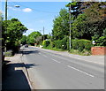
Visibility mirror, Westward Road, Stroud
The mirror on the right is at the entrance to number 330 Westward Road.
Image: © Jaggery
Taken: 7 May 2017
0.12 miles
8
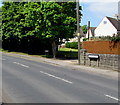
From Westward Road to Ebley Road, Stroud
Viewed across the B4008. The Westward Road name sign on the right is a few metres
from the Ebley Road name sign near a tree. The Stonehouse boundary sign is nearby. http://www.geograph.org.uk/photo/5384639
Image: © Jaggery
Taken: 7 May 2017
0.12 miles
9
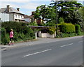
Jogger in Ebley, Stroud
Sunday jogger heading east on the pavement on the north side of the B4008 Westward Road.
Image: © Jaggery
Taken: 7 May 2017
0.12 miles
10
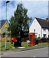
Communications area, Orchard Road, Ebley, Stroud
In view in May 2017 are a red phonebox, red postbox and two dark green telecoms cabinets.
Image: © Jaggery
Taken: 7 May 2017
0.12 miles